MyTopo
Hazelhurst Wisconsin US Topo Map
Couldn't load pickup availability
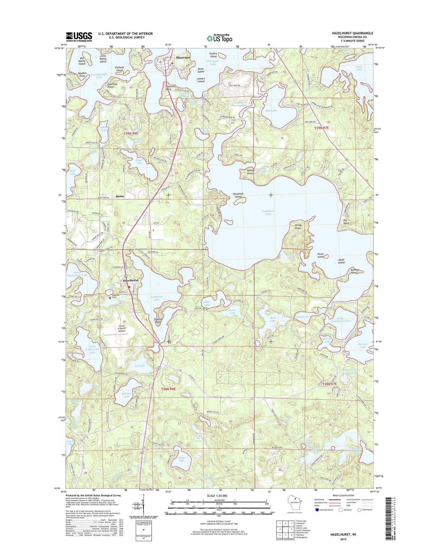
2022 topographic map quadrangle Hazelhurst in the state of Wisconsin. Scale: 1:24000. Based on the newly updated USGS 7.5' US Topo map series, this map is in the following counties: Oneida. The map contains contour data, water features, and other items you are used to seeing on USGS maps, but also has updated roads and other features. This is the next generation of topographic maps. Printed on high-quality waterproof paper with UV fade-resistant inks.
Quads adjacent to this one:
West: Mercer Lake
Northwest: Fence Lake
North: Woodruff
Northeast: Sayner
East: Lake Tomahawk
Southeast: McNaughton
South: Harshaw
Southwest: Burrows Lake
This map covers the same area as the classic USGS quad with code o45089g6.
Contains the following named places: Alice Lake, Baker Lake, Berry Lake, Big Carr Lake, Big Ripley Island, Bird Lake, Bolger Lake, Camp American Legion, Camp Kawaga, Camp Strongheart, Camp Twenty-one Lake, Circle A Ranch Airport, Clawson Lake, Clawsons Point, Daniels Point, Dead Island, Dollar Lake, Doolittle Point, Dry Point, Dugout Lake, Fiefield Island, Fishers Island, Foster Lake, Hazelhurst, Hazelhurst Canal, Hazelhurst Post Office, Hazelhurst Volunteer Fire Department, Hickson School, Indian Mound Campground, Inkpot Lake, Inkwell Lake, Jerome Lake, Jossart Island, Jyme Lake, Katherine Lake, Kawaguesaga Lake, Kemps Biological Center, Kemps Point, Kline Island, Lakeside Cemetery, Lee Lake, Little Ripley Island, Little Tomahawk Lake, Lower Kaubashine Lake, Madden Point, McGrath Lake, McNaughton State Camp, McNutt Lake, Mid Lake, Miller Lake, Minocqua, Minocqua Community Building, Minocqua Country Club, Minocqua Elementary School, Minocqua Fire Department - Station 1, Minocqua Lake, Minocqua Museum, Minocqua Police Department, Minocqua Post Office, Minocqua Public Library, Minocqua-Hazelhurst School, Mud Lake, Northwoods Unitarian-Universalist Fellowship, Olmstead Island, Papkee Lake, Picnic Island, Porcupine Lake, Rantz, Rockpile Pond, Rocky Run Springs, Romans Point, Round Lake, Saint Andrews Orthodox Mission, Saint Matthias Episcopal Church, Schlecht Lake, Scott Springs, South Blue Lake, Sunflower, Swartz Lake, Tigertail Point, Tomahawk Lake, Tomahawk Thoroughfare, Torpy Park, Town of Hazelhurst, Upper Kaubashine Lake, Wind Pudding Lake, Wind Pudding Lake State Natural Area, Windy Point, WMYM-AM (Minocqua), Wolosz Pond, WWMH-FM (Minocqua), Yawkey Lake