MyTopo
Milltown Wisconsin US Topo Map
Couldn't load pickup availability
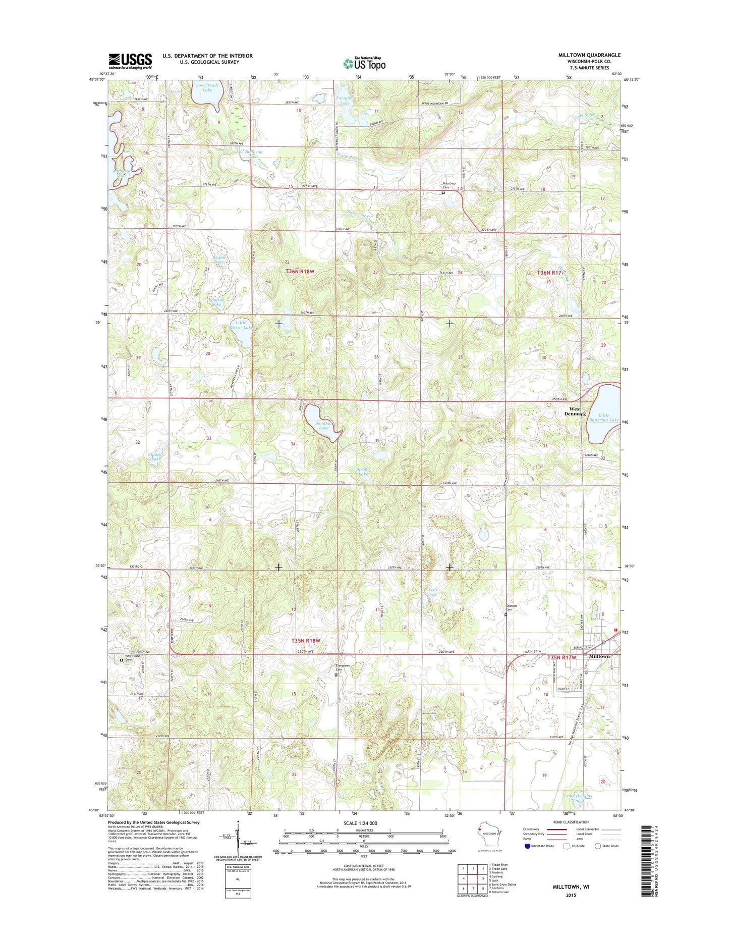
2018 topographic map quadrangle Milltown in the state of Wisconsin. Scale: 1:24000. Based on the newly updated USGS 7.5' US Topo map series, this map is in the following counties: Polk. The map contains contour data, water features, and other items you are used to seeing on USGS maps, but also has updated roads and other features. This is the next generation of topographic maps. Printed on high-quality waterproof paper with UV fade-resistant inks.
Quads adjacent to this one:
West: Cushing
Northwest: Trade River
North: Trade Lake
Northeast: Frederic
East: Luck
Southeast: Balsam Lake
South: Centuria
Southwest: Saint Croix Dalles
Contains the following named places: Alabama Lake, Alabama School, Bullhead Lake, Butternut Creek, Camp Douglas Lake, Clauson Lake, Ellofson Lake, Forsythe Lake, Granum Cemetery, Haustrup Cemetery, Laketown Church, Laketown Townhall, Lanesdale School, Lees Lake, Little Butternut Lake, Little Mirror Lake, Long Trade Lake, Milltown, Milltown Police Department, Milltown Post Office, Milltown Volunteer Fire Department, New Home Cemetery, North Valley Cemetery, North Valley Church, Oak Hill School, Pleasant Valley School, Sandhill Lake, South Branch Trade River, Spring Lake, Town of Eureka, Town of Laketown, Trap Rock School, Unity Area Ambulance, Village of Milltown, Wallin Lake, West Denmark