MyTopo
Centuria Wisconsin US Topo Map
Couldn't load pickup availability
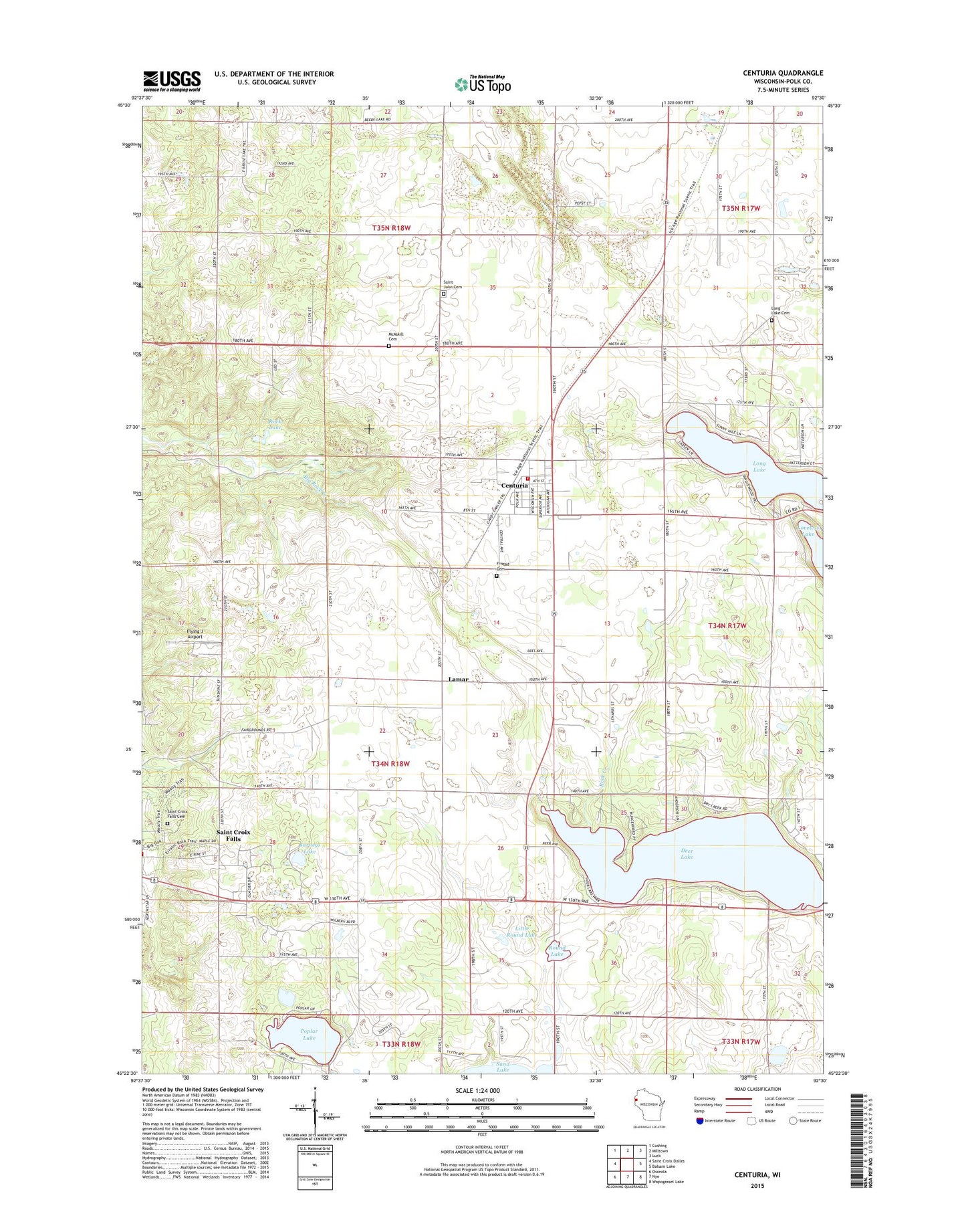
2022 topographic map quadrangle Centuria in the state of Wisconsin. Scale: 1:24000. Based on the newly updated USGS 7.5' US Topo map series, this map is in the following counties: Polk. The map contains contour data, water features, and other items you are used to seeing on USGS maps, but also has updated roads and other features. This is the next generation of topographic maps. Printed on high-quality waterproof paper with UV fade-resistant inks.
Quads adjacent to this one:
West: Saint Croix Dalles
Northwest: Cushing
North: Milltown
Northeast: Luck
East: Balsam Lake
Southeast: Wapogasset Lake
South: Nye
Southwest: Osceola
This map covers the same area as the classic USGS quad with code o45092d5.
Contains the following named places: Barneys Lake, Centuria, Centuria Police Department Administration, Centuria Post Office, Centuria Volunteer Fire Department, Deer Lake, Flying J Airport, Fristad Cemetery, Lamar, Little Round Lake, Long Lake, Long Lake Cemetery, Long Lake Park, McAskill Cemetery, Poplar Lake, Rock Creek, Rock Lake, Round Lake, Saint Croix Falls Cemetery, Saint Croix Falls Townhall, Saint John Cemetery, Saint Pauls Camp, South Milltown School, Town of Saint Croix Falls, Village of Centuria, Woodrow School, ZIP Code: 54824