MyTopo
Minong Flowage Wisconsin US Topo Map
Couldn't load pickup availability
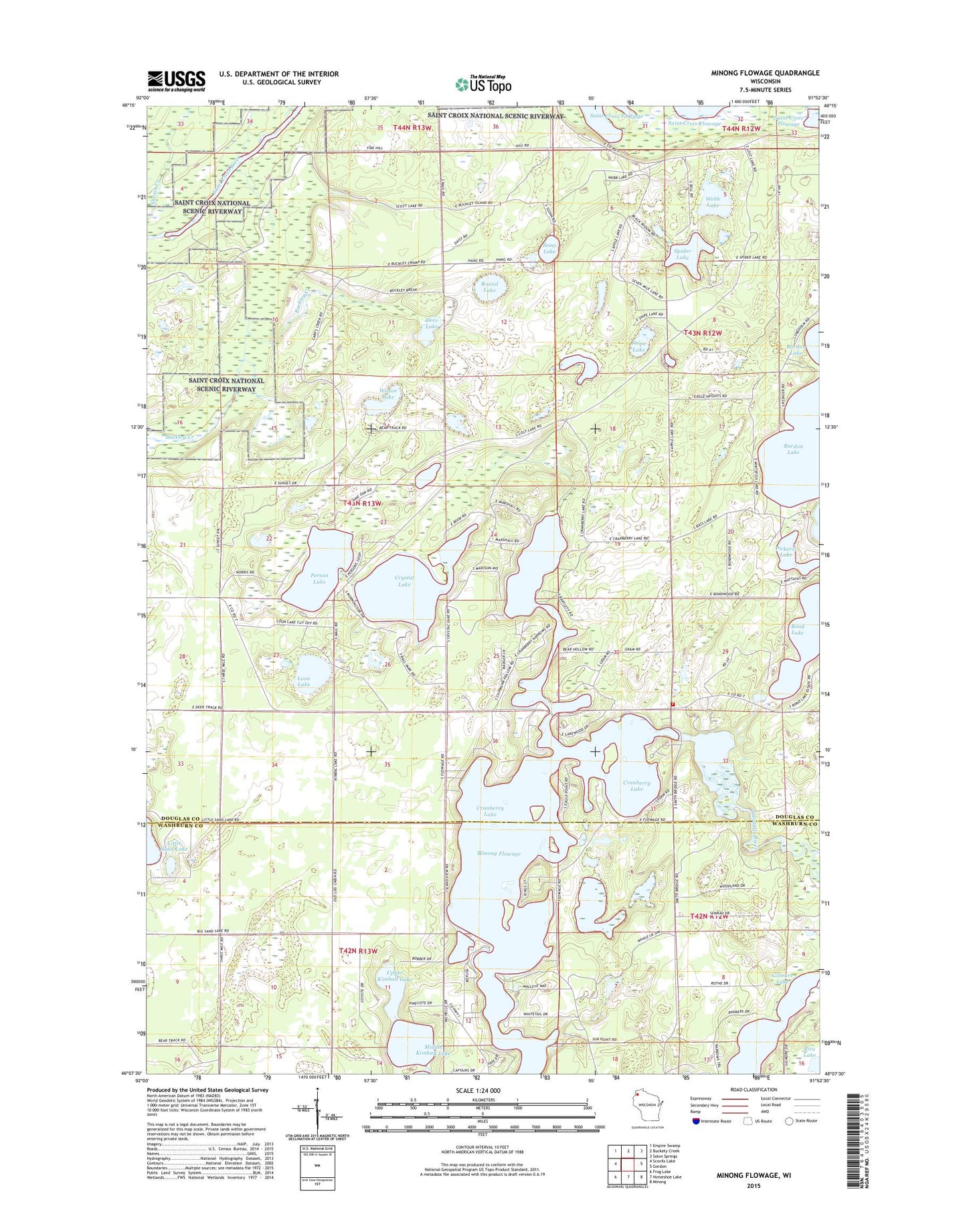
2019 topographic map quadrangle Minong Flowage in the state of Wisconsin. Scale: 1:24000. Based on the newly updated USGS 7.5' US Topo map series, this map is in the following counties: Douglas, Washburn. The map contains contour data, water features, and other items you are used to seeing on USGS maps, but also has updated roads and other features. This is the next generation of topographic maps. Printed on high-quality waterproof paper with UV fade-resistant inks.
Quads adjacent to this one:
West: Scovils Lake
Northwest: Empire Swamp
North: Buckety Creek
Northeast: Solon Springs
East: Gordon
Southeast: Minong
South: Horseshoe Lake
Southwest: Frog Lake
Contains the following named places: Apple Lake, Bergen Creek, Cranberry Lake, Crystal Lake, Deer Lake, Gilmore Lake, Loon Lake, Middle Kimball Lake, Person Lake, Pickerel Lake, Round Lake, Scott Lake, Snipe Lake, Spider Lake, Totagatic County Park, Upper Kimball Lake, Wascott Volunteer Fire Department, Webb Lake, Wilson Lake