MyTopo
Minong Wisconsin US Topo Map
Couldn't load pickup availability
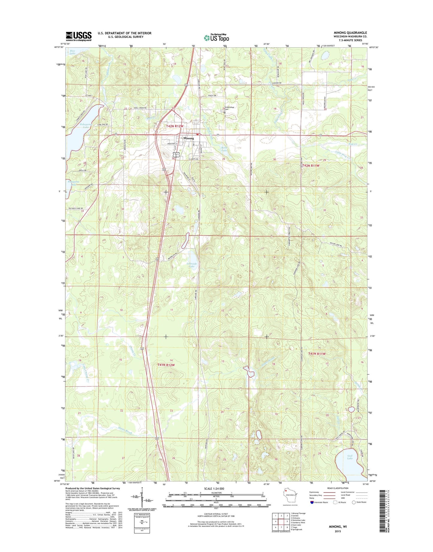
2022 topographic map quadrangle Minong in the state of Wisconsin. Scale: 1:24000. Based on the newly updated USGS 7.5' US Topo map series, this map is in the following counties: Washburn. The map contains contour data, water features, and other items you are used to seeing on USGS maps, but also has updated roads and other features. This is the next generation of topographic maps. Printed on high-quality waterproof paper with UV fade-resistant inks.
Quads adjacent to this one:
West: Horseshoe Lake
Northwest: Minong Flowage
North: Gordon
Northeast: Chittamo
East: Stanberry West
Southeast: Springbrook
South: Trego
Southwest: Dunn Lake
This map covers the same area as the classic USGS quad with code o46091a7.
Contains the following named places: Bond Lake, Fischer Dam WP380, Greenwood Cemetery, Lakeside Lake, Little Frog Creek, Minong, Minong Post Office, Pokegama Lake, Round Lake, Sink Creek, Stuntz Brook, Town of Brooklyn, Tucker Lake, Village of Minong, ZIP Code: 54859