MyTopo
Horseshoe Lake Wisconsin US Topo Map
Couldn't load pickup availability
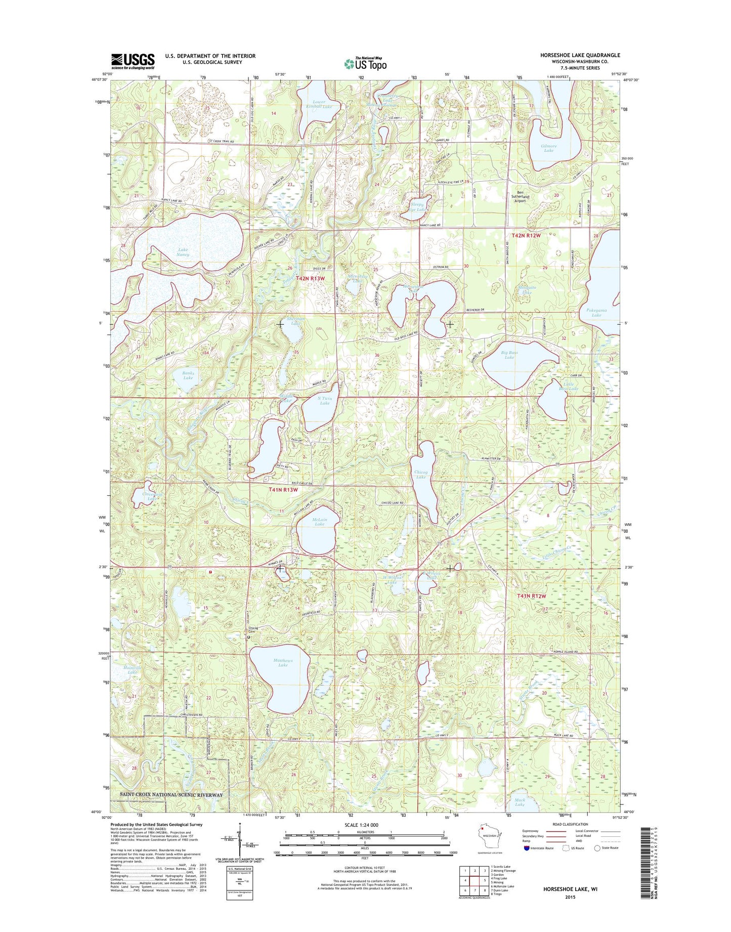
2022 topographic map quadrangle Horseshoe Lake in the state of Wisconsin. Scale: 1:24000. Based on the newly updated USGS 7.5' US Topo map series, this map is in the following counties: Washburn. The map contains contour data, water features, and other items you are used to seeing on USGS maps, but also has updated roads and other features. This is the next generation of topographic maps. Printed on high-quality waterproof paper with UV fade-resistant inks.
Quads adjacent to this one:
West: Frog Lake
Northwest: Scovils Lake
North: Minong Flowage
Northeast: Gordon
East: Minong
Southeast: Trego
South: Dunn Lake
Southwest: McKenzie Lake
This map covers the same area as the classic USGS quad with code o46091a8.
Contains the following named places: Adventure Lake, Banks Lake, Ben Sutherland Airport, Big Bass Lake, Bughouse Lake, Byrkits Landing, Chicog Cemetery, Chicog Creek, Chicog Lake, Chicog Townhall, Chicog Volunteer Fire Department, Cloverleaf Lake, East Wilcox Lake, Gilmore Lake, Hoinville Lake, Horseshoe Lake, Lake Nancy, Little Bass Lake, Little Chicog Creek, Lower Kimball Lake, Lower Kimball Lake 6, Lower Kimball Lake Dam, Mack Lake, Matthews Lake, McLain Lake, Middle Lake, Minong Area Ambulance Service, Minong Flowage, Minong Flowage 2WP252 Dam, Minong Flowage 320, Minong Police Department, Minong Volunteer Fire Department, Mosquito Lake, North Twin Lake, Sherman Lake, Sleepy Eye Lake, South Twin Lake, Town of Chicog, Town of Minong, Twin Lakes, West Wilcox Lake, Wilcox Lake