MyTopo
Montfort Wisconsin US Topo Map
Couldn't load pickup availability
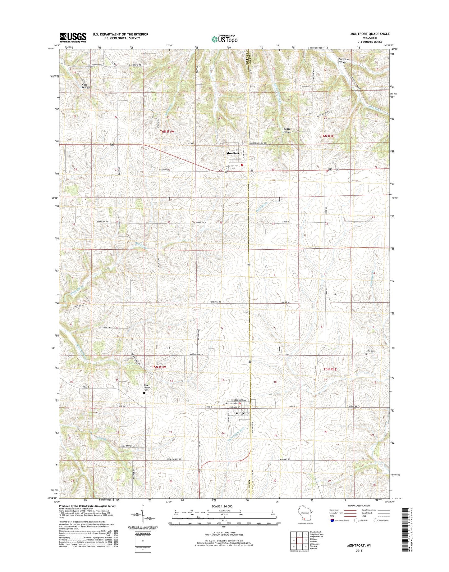
2018 topographic map quadrangle Montfort in the state of Wisconsin. Scale: 1:24000. Based on the newly updated USGS 7.5' US Topo map series, this map is in the following counties: Grant, Iowa. The map contains contour data, water features, and other items you are used to seeing on USGS maps, but also has updated roads and other features. This is the next generation of topographic maps. Printed on high-quality waterproof paper with UV fade-resistant inks.
Quads adjacent to this one:
West: Stitzer
Northwest: Castle Rock
North: Highland West
Northeast: Highland East
East: Linden
Southeast: Mifflin
South: Rewey
Southwest: Ellenboro
Contains the following named places: Bethel School, Bollant Farms, Foreman Hollow, Hopewell School, Iowa - Grant Elementary / Middle School, Iowa - Grant High School, Little German Church On Top Of The Hill Cemetery, Livingston, Livingston - Clifton Fire Department, Livingston Post Office, Martinville School, Mifflin Mine, Montfort, Montfort Post Office, Montfort Volunteer Fire Department, Oak Grove School, Rock Church Cemetery, Stivarius Farm, Sunnyside School, Sylvesters Creek, Town of Clifton, Town of Wingville, Village of Livingston, Village of Montfort, Waterloo School, WJTY-FM (Lancaster), ZIP Codes: 53554, 53569