MyTopo
Linden Wisconsin US Topo Map
Couldn't load pickup availability
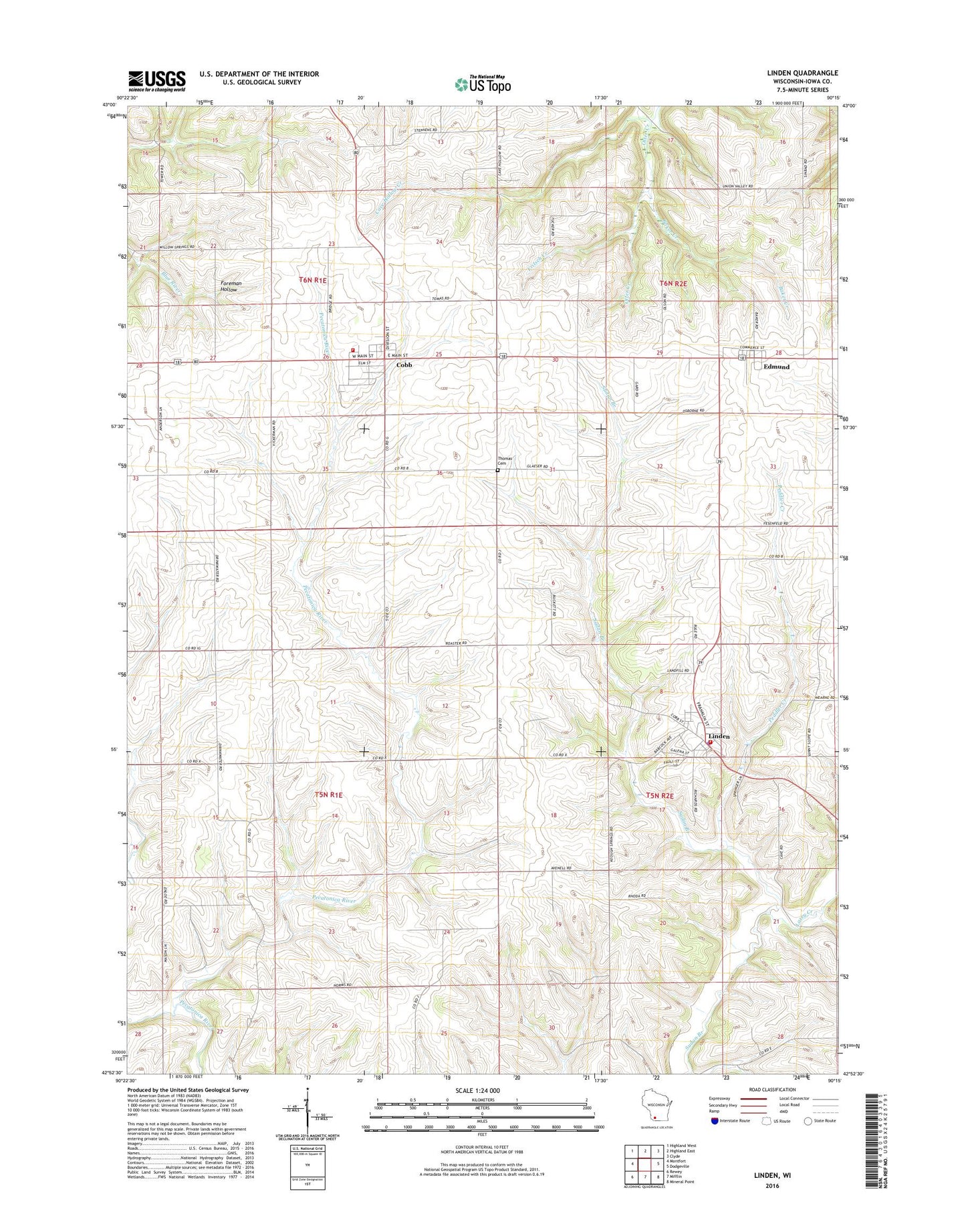
2022 topographic map quadrangle Linden in the state of Wisconsin. Scale: 1:24000. Based on the newly updated USGS 7.5' US Topo map series, this map is in the following counties: Iowa. The map contains contour data, water features, and other items you are used to seeing on USGS maps, but also has updated roads and other features. This is the next generation of topographic maps. Printed on high-quality waterproof paper with UV fade-resistant inks.
Quads adjacent to this one:
West: Montfort
Northwest: Highland West
North: Highland East
Northeast: Clyde
East: Dodgeville
Southeast: Mineral Point
South: Mifflin
Southwest: Rewey
This map covers the same area as the classic USGS quad with code o42090h3.
Contains the following named places: 0.6 Reservoir, 53526, 53553, Baker Creek, Cave Hollow Creek, Cobb, Cobb Post Office, Cobb Volunteer Fire Department, Edmund, Edmund Census Designated Place, Fritsch Creek, Johnston Quarry, Keo Springs School, Laxey Creek, Linden, Linden Police Department, Linden Post Office, Linden Volunteer Fire Department, Livingston Branch, Mount Vernon School, New Providence School, Peddler Creek, Robert Coyier G9994 Dam, Stephens Quarry, Sunny Slope School, Thomas Cemetery, Town of Eden, Town of Linden, Town of Mifflin, Village of Cobb, Village of Linden, Whitson View School, Willow Grove School