MyTopo
Stitzer Wisconsin US Topo Map
Couldn't load pickup availability
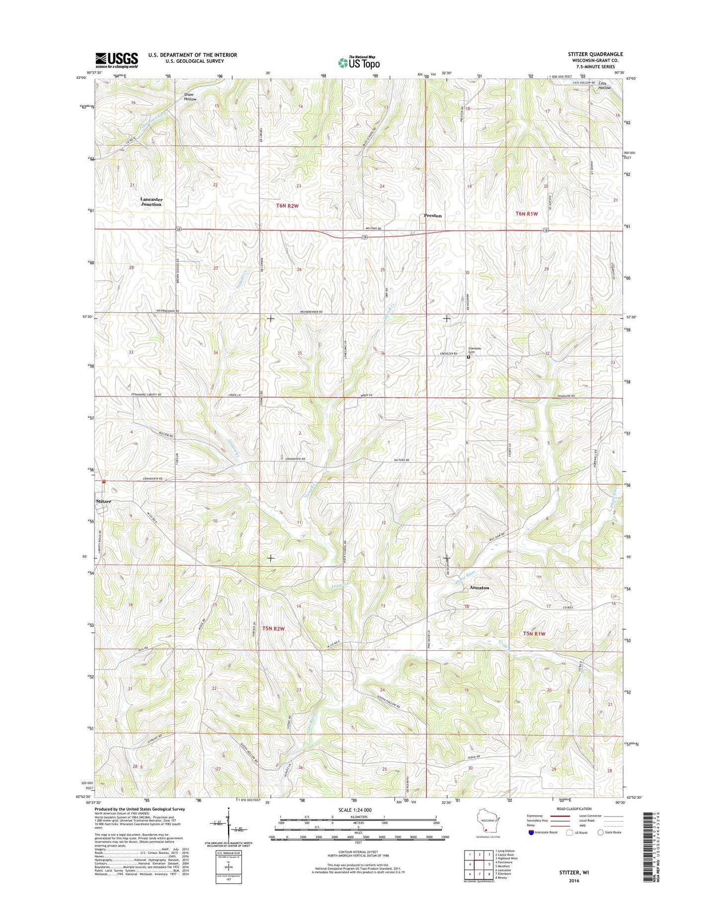
2022 topographic map quadrangle Stitzer in the state of Wisconsin. Scale: 1:24000. Based on the newly updated USGS 7.5' US Topo map series, this map is in the following counties: Grant. The map contains contour data, water features, and other items you are used to seeing on USGS maps, but also has updated roads and other features. This is the next generation of topographic maps. Printed on high-quality waterproof paper with UV fade-resistant inks.
Quads adjacent to this one:
West: Fennimore
Northwest: Long Hollow
North: Castle Rock
Northeast: Highland West
East: Montfort
Southeast: Rewey
South: Ellenboro
Southwest: Lancaster
This map covers the same area as the classic USGS quad with code o42090h5.
Contains the following named places: Annaton, Blue School, Crow Branch, Ebenezer Cemetery, Lancaster Junction, Larch Grove Farm, Leggett Creek, Martinville Creek, Newell Creek, Preston, Stitzer, Stitzer Post Office, Stitzer Volunteer Fire Department, Town of Fennimore, Town of Liberty, ZIP Code: 53825