MyTopo
Moose Junction Wisconsin US Topo Map
Couldn't load pickup availability
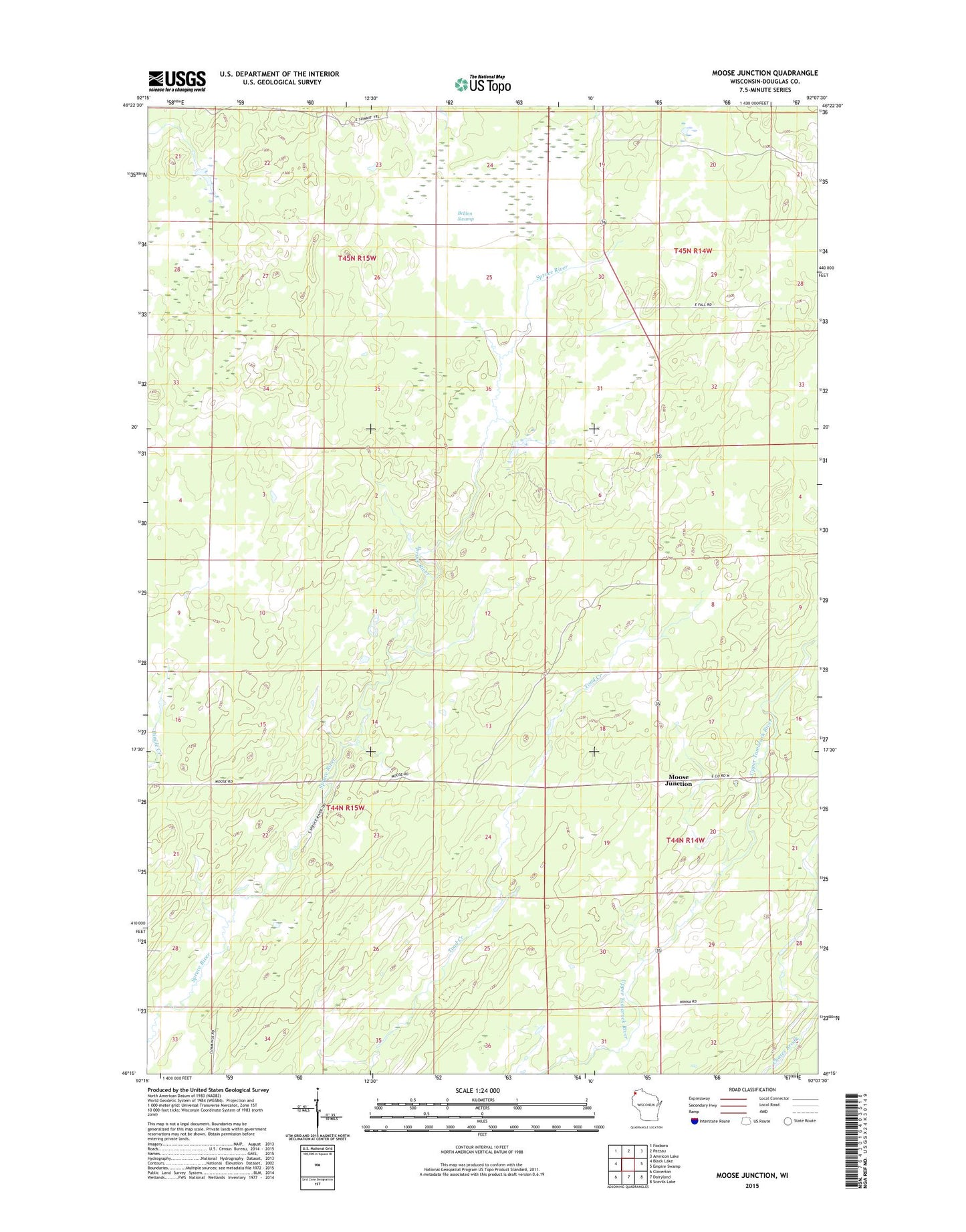
2022 topographic map quadrangle Moose Junction in the state of Wisconsin. Scale: 1:24000. Based on the newly updated USGS 7.5' US Topo map series, this map is in the following counties: Douglas. The map contains contour data, water features, and other items you are used to seeing on USGS maps, but also has updated roads and other features. This is the next generation of topographic maps. Printed on high-quality waterproof paper with UV fade-resistant inks.
Quads adjacent to this one:
West: Black Lake
Northwest: Foxboro
North: Patzau
Northeast: Amnicon Lake
East: Empire Swamp
Southeast: Scovils Lake
South: Dairyland
Southwest: Cloverton
This map covers the same area as the classic USGS quad with code o46092c2.
Contains the following named places: Belden Swamp, Moose Junction