
MyTopo
Mukwonago Wisconsin US Topo Map
Couldn't load pickup availability
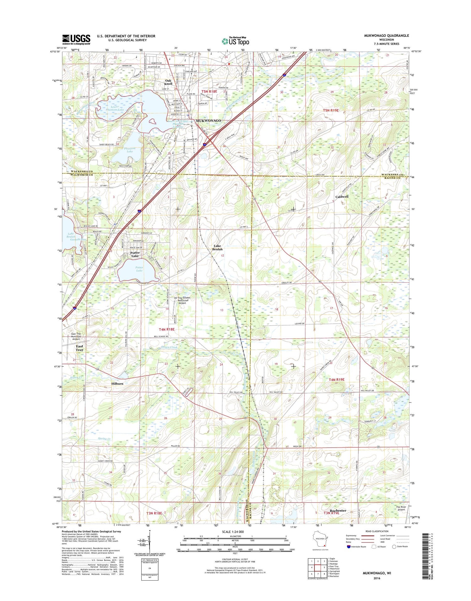
2018 topographic map quadrangle Mukwonago in the state of Wisconsin. Scale: 1:24000. Based on the newly updated USGS 7.5' US Topo map series, this map is in the following counties: Walworth, Racine, Waukesha. The map contains contour data, water features, and other items you are used to seeing on USGS maps, but also has updated roads and other features. This is the next generation of topographic maps. Printed on high-quality waterproof paper with UV fade-resistant inks.
Quads adjacent to this one:
West: East Troy
Northwest: Eagle
North: Genesee
Northeast: Muskego
East: Waterford
Southeast: Rochester
South: Burlington
Southwest: Springfield
Contains the following named places: Air Troy Estates - Restricted Airport, Buttles School, Caldwell, Caldwell Elementary School, Caldwell United Methodist Church, Clarendon Avenue Elementary School, East Troy Town Police Department, Field Park, Gaskells Bay, Hilburn, Hilburn Pond, Jonesville School, Lake Beulah, Lower and Upper Phantom Lakes 60, Lower Phantom Lake, Midway, Mukwonago, Mukwonago Baptist Academy, Mukwonago Dam, Mukwonago Fire Department Station 1, Mukwonago High School, Mukwonago Police Department, Mukwonago Post Office, Mukwonago River, Mukwonago River State Natural Area, Oak Knoll, Park View Middle School, Phantom Lake, Phantom Ranch Boys Camp, Potter Lake, Potter Lake Census Designated Place, Saint James Catholic School, Saint Johns Lutheran School, Spring Creek, Stewart School, Stone Elementary School, Town of East Troy, Town of Waterford, Village of Mukwonago, Village of Mukwonago Wastewater Treatment Plant


