MyTopo
Springfield Wisconsin US Topo Map
Couldn't load pickup availability
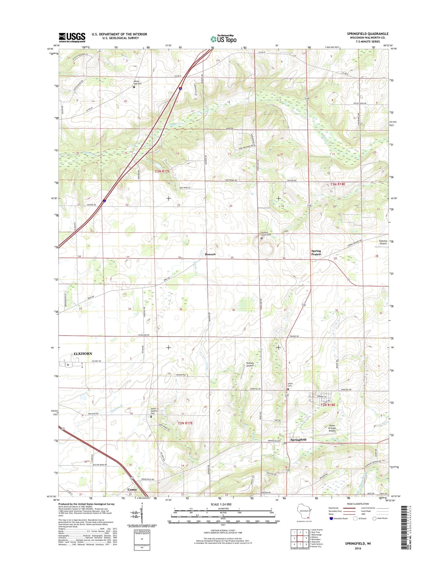
2022 topographic map quadrangle Springfield in the state of Wisconsin. Scale: 1:24000. Based on the newly updated USGS 7.5' US Topo map series, this map is in the following counties: Walworth. The map contains contour data, water features, and other items you are used to seeing on USGS maps, but also has updated roads and other features. This is the next generation of topographic maps. Printed on high-quality waterproof paper with UV fade-resistant inks.
Quads adjacent to this one:
West: Elkhorn
Northwest: Little Prairie
North: East Troy
Northeast: Mukwonago
East: Burlington
Southeast: Genoa City
South: Lake Geneva
Southwest: Walworth
This map covers the same area as the classic USGS quad with code o42088f4.
Contains the following named places: Aurora Lakeland Medical Center, Barker Strip Airport, Bowers, East Area School, Elmer Droster E5299 Dam, Hickory Grove Cemetery, Lafayette Church, Lakeland Hospital Heliport, Lakeland School, Mount Fuji Airport, North Geneva Cemetery, Palotti Novitiate, Plows & Props Airport, Spring Prairie, Springfield, Springfield Census Designated Place, Springfield Post Office, Terhark Airport, Town of Geneva, Town of Lafayette, Union Cemetery, Walworth County Hospital, Walworth County Jail, Walworth County Sheriff's Office, White Oak Cemetery