
MyTopo
Norton Wisconsin US Topo Map
Couldn't load pickup availability
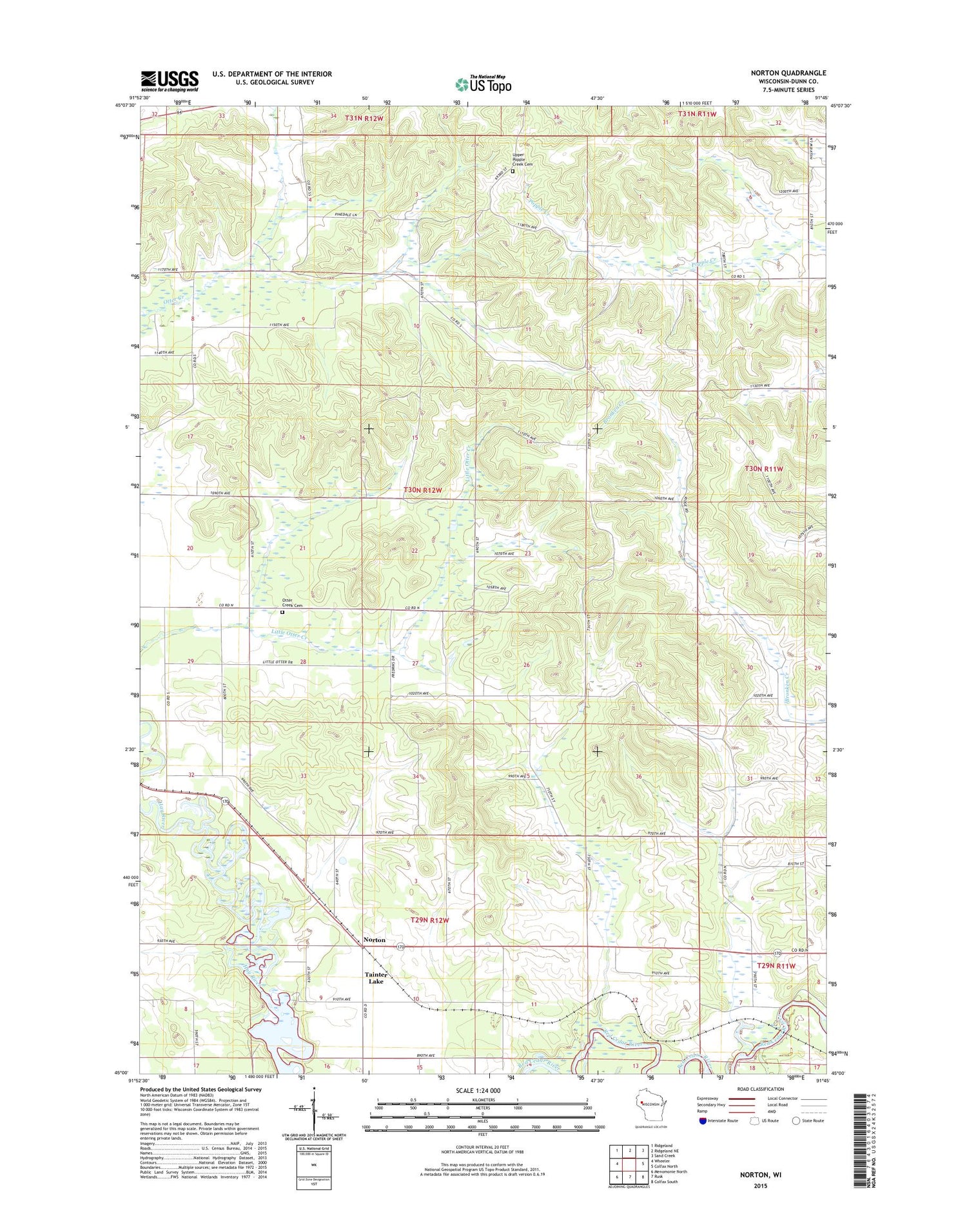
2018 topographic map quadrangle Norton in the state of Wisconsin. Scale: 1:24000. Based on the newly updated USGS 7.5' US Topo map series, this map is in the following counties: Dunn. The map contains contour data, water features, and other items you are used to seeing on USGS maps, but also has updated roads and other features. This is the next generation of topographic maps. Printed on high-quality waterproof paper with UV fade-resistant inks.
Quads adjacent to this one:
West: Wheeler
Northwest: Ridgeland
North: Ridgeland NE
Northeast: Sand Creek
East: Colfax North
Southeast: Colfax South
South: Rusk
Southwest: Menomonie North
Contains the following named places: Deepwood Golf Course, Hay River, Little Otter School, Misselt School, Model School, Norton, Norton Church, Oak Grove School, Otter Creek Cemetery, Otter Creek Church, Otter Creek Oak Barrens State Natural Area, Otter Creek State Fishery Area, Otter Creek Townhall, Town of Otter Creek, Twin Valley School, Upper Popple Creek Cemetery, Upper Popple Creek Church, WHWC-FM (Menomonie), WHWC-TV (Menomonie)


