MyTopo
Ridgeland Wisconsin US Topo Map
Couldn't load pickup availability
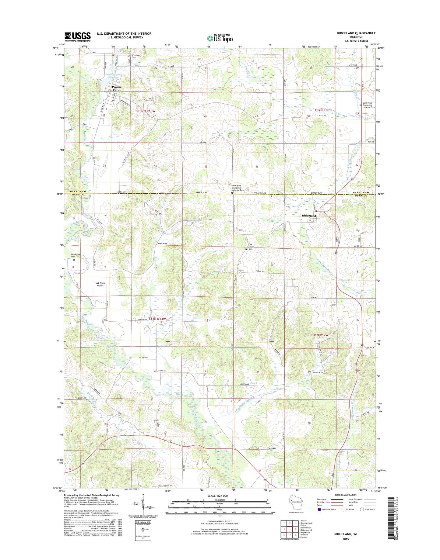
2022 topographic map quadrangle Ridgeland in the state of Wisconsin. Scale: 1:24000. Based on the newly updated USGS 7.5' US Topo map series, this map is in the following counties: Dunn, Barron. The map contains contour data, water features, and other items you are used to seeing on USGS maps, but also has updated roads and other features. This is the next generation of topographic maps. Printed on high-quality waterproof paper with UV fade-resistant inks.
Quads adjacent to this one:
West: Connorsville
Northwest: Arland
North: Dorrity Creek
Northeast: Dallas
East: Ridgeland NE
Southeast: Norton
South: Wheeler
Southwest: Boyceville
This map covers the same area as the classic USGS quad with code o45091b8.
Contains the following named places: Bilse School, Blairmoor School, Cub Acres Airport, Dammon Ridge School, Evergreen Cemetery, Faith Church, Harmon Brothers Landing Strip, Key School, Little Beaver School, Oak Grove Cemetery, Parkman School, Pioneer Park, Prairie Farm, Prairie Farm - Sheridan Fire Department, Prairie Farm Dam, Prairie Farm Elementary School, Prairie Farm Flowage, Prairie Farm High School, Prairie Farm Middle School, Prairie Farm Post Office, Ridgeland, Ridgeland - Dallas Elementary School, Ridgeland - Wilson Fire Department, Ridgeland Post Office, Saint Pauls Church, Saint Pauls Evangelical Lutheran Cemetery, Spring Creek, Town of Sheridan, Turtle Creek, Vanceburg Cemetery, Vanceburg School, Village of Prairie Farm, Village of Ridgeland, Washburn Farm Creek, Washburn Farm School, Wilson Townhall, Zion Church, ZIP Codes: 54762, 54763