MyTopo
Oak Island Wisconsin US Topo Map
Couldn't load pickup availability
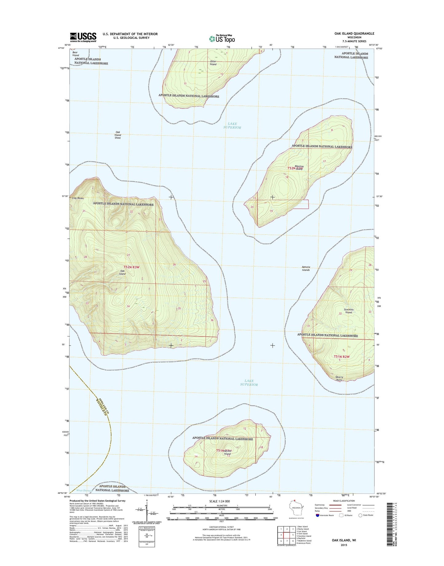
2022 topographic map quadrangle Oak Island in the state of Wisconsin. Scale: 1:24000. Based on the newly updated USGS 7.5' US Topo map series, this map is in the following counties: Ashland, Bayfield. The map contains contour data, water features, and other items you are used to seeing on USGS maps, but also has updated roads and other features. This is the next generation of topographic maps. Printed on high-quality waterproof paper with UV fade-resistant inks.
Quads adjacent to this one:
West: York Island
Northwest: Bear Island
North: Rocky Island
Northeast: Cat Island
East: Stockton Island
Southeast: Amnicon Point
South: Madeline Island
Southwest: Bayfield
Contains the following named places: Apostle Islands, Apostle Islands National Lakeshore, Apostle Islands State Forest, Clay Banks, Hermit Island, Manitou Camp, Manitou Island, Oak Island, Oak Island Shoal, Otter Island, Quarry Point