
MyTopo
Ogema Wisconsin US Topo Map
Couldn't load pickup availability
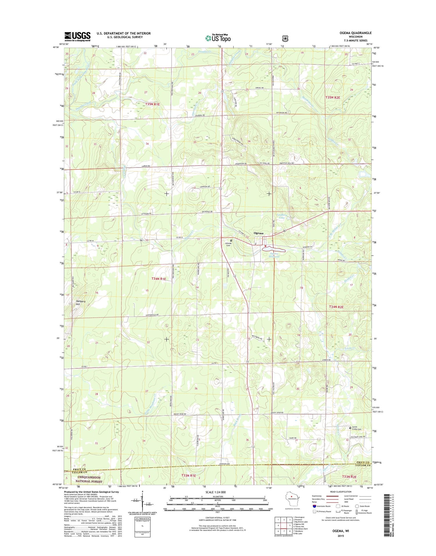
2018 topographic map quadrangle Ogema in the state of Wisconsin. Scale: 1:24000. Based on the newly updated USGS 7.5' US Topo map series, this map is in the following counties: Price, Taylor. The map contains contour data, water features, and other items you are used to seeing on USGS maps, but also has updated roads and other features. This is the next generation of topographic maps. Printed on high-quality waterproof paper with UV fade-resistant inks.
Quads adjacent to this one:
West: Ogema NW
Northwest: Pennington
North: Prentice
Northeast: Big Briens Lake
East: Timms Hill
Southeast: Rib Lake
South: Westboro
Southwest: Mondeaux Dam
Contains the following named places: Alcohol Creek, Centerville School, Douglas Creek, Forest Hill School, Golden Creek, Hallberg Hill, Hill Townhall, Hillside Cemetery, Holmes Creek, Larkin School, Levitt Creek, Levitt Creek Cemetery, Levitt Creek School, Lindberg Lake, Mackeys Spur, Mondeaux Creek, North Branch Holmes Creek, Ogema, Ogema Census Designated Place, Ogema Dam, Ogema Elementary School, Ogema Millpond, Ogema Post Office, Ogema Volunteer Fire Company, Ottertail Creek, Ottertail Springs, Pinewood School, Sunnyside School


