MyTopo
Rib Lake Wisconsin US Topo Map
Couldn't load pickup availability
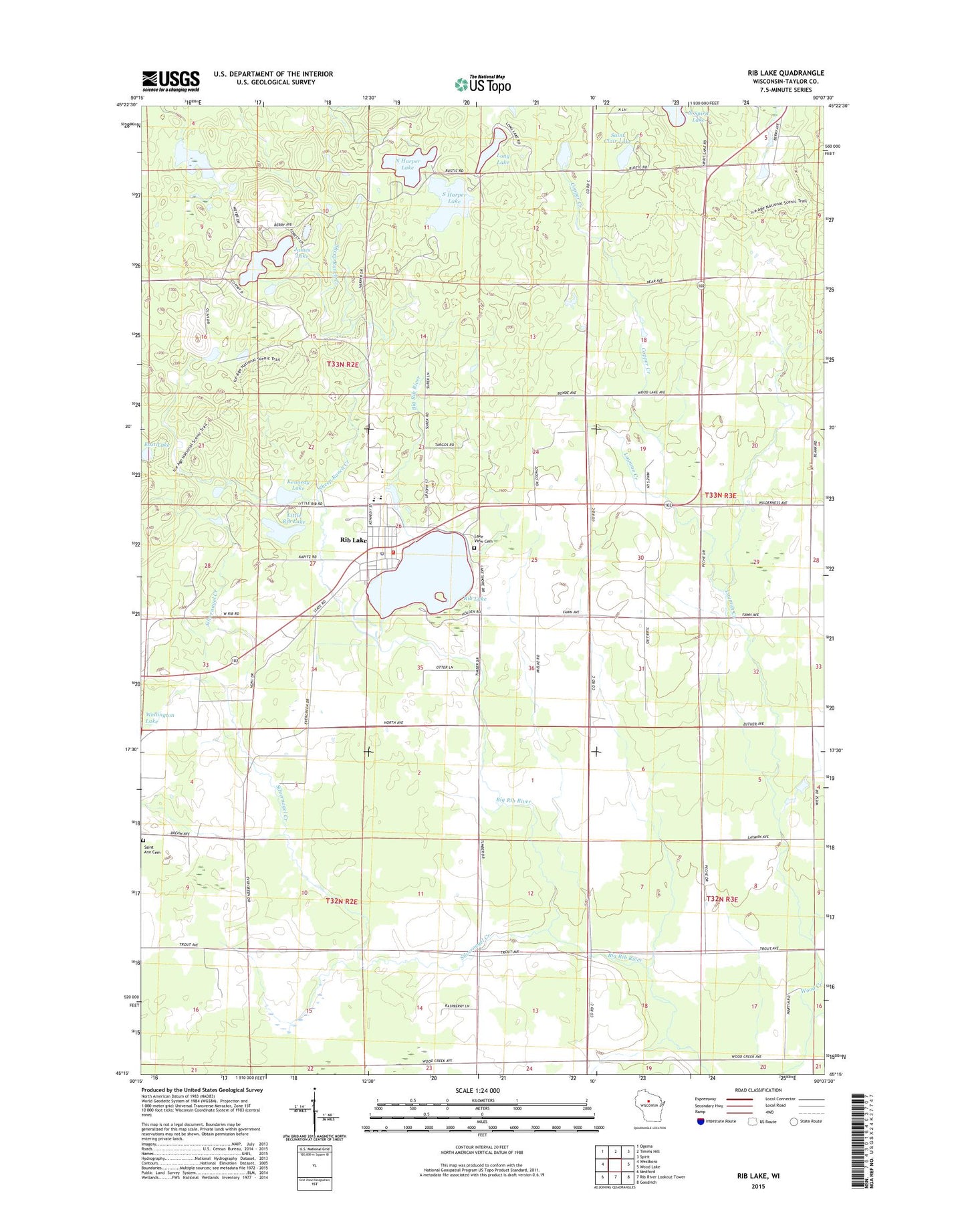
2022 topographic map quadrangle Rib Lake in the state of Wisconsin. Scale: 1:24000. Based on the newly updated USGS 7.5' US Topo map series, this map is in the following counties: Taylor. The map contains contour data, water features, and other items you are used to seeing on USGS maps, but also has updated roads and other features. This is the next generation of topographic maps. Printed on high-quality waterproof paper with UV fade-resistant inks.
Quads adjacent to this one:
West: Westboro
Northwest: Ogema
North: Timms Hill
Northeast: Spirit
East: Wood Lake
Southeast: Goodrich
South: Rib River Lookout Tower
Southwest: Medford
This map covers the same area as the classic USGS quad with code o45090c2.
Contains the following named places: 1 Reservoir, 54470, Camp Forest Springs, Clearview Elementary School, Copper Creek, Dr Walther W Meyer Number 3 G4914 Dam, East Lake, Fawn Valley School, James Lake, Kennedy Lake, Lake View Park, Lakeview Cemetery, Layman Creek, Little Rib Lake, Long Lake, North Harper Lake, Porky Creek, Rib Lake, Rib Lake Elementary School, Rib Lake High School, Rib Lake Middle School, Rib Lake Police Department, Rib Lake Post Office, Rib Lake Volunteer Fire Department, Rib River School, Saint Ann Church, Saint Clair Lake, Sheep Ranch Creek, Silvernagel Creek, South Harper Lake, Taylor County Ambulance Service - Rib Lake, Town of Rib Lake, Village of Rib Lake, Village of Rib Lake Wastewater Treatment Facility