
MyTopo
Peplin Wisconsin US Topo Map
Couldn't load pickup availability
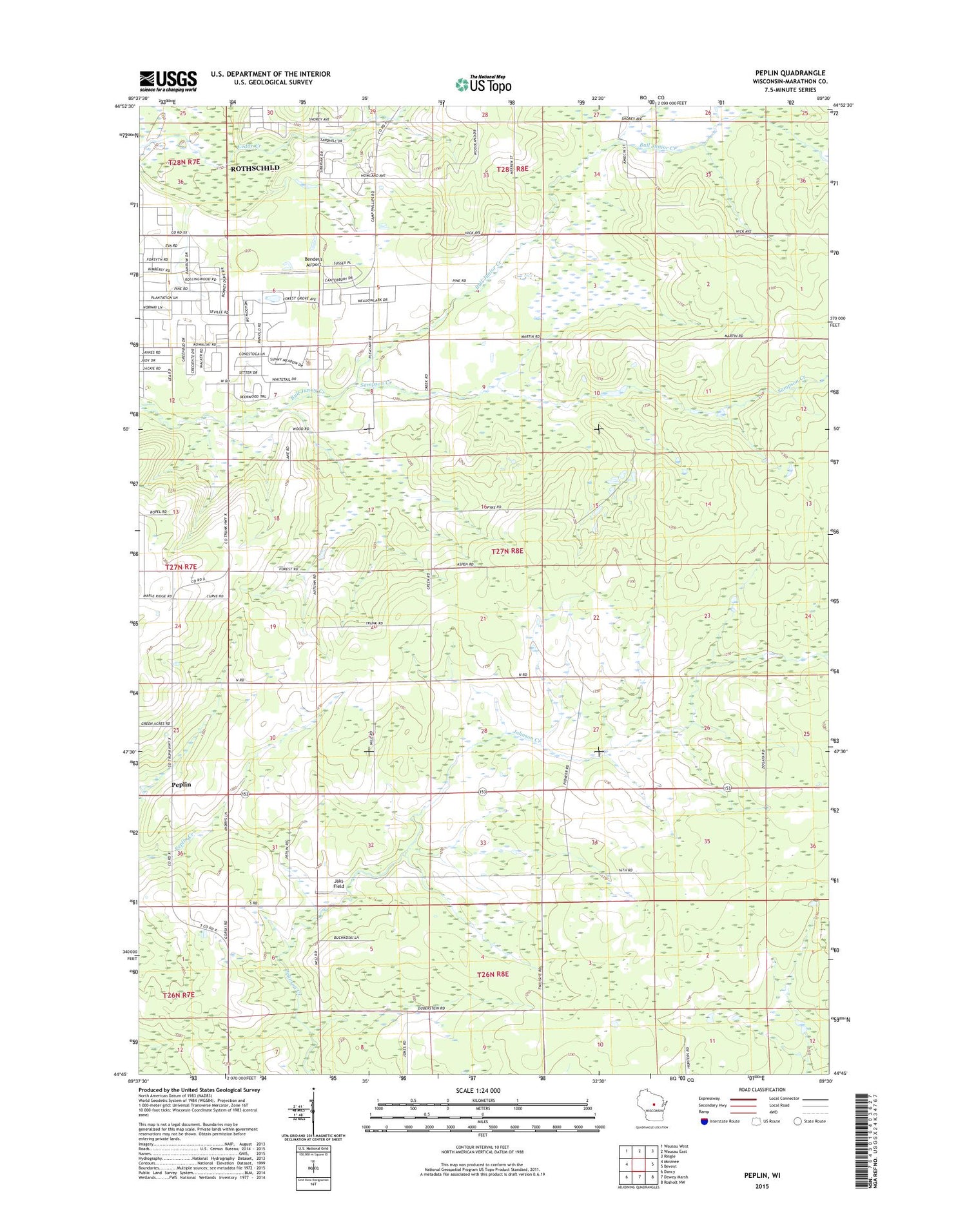
2018 topographic map quadrangle Peplin in the state of Wisconsin. Scale: 1:24000. Based on the newly updated USGS 7.5' US Topo map series, this map is in the following counties: Marathon. The map contains contour data, water features, and other items you are used to seeing on USGS maps, but also has updated roads and other features. This is the next generation of topographic maps. Printed on high-quality waterproof paper with UV fade-resistant inks.
Quads adjacent to this one:
West: Mosinee
Northwest: Wausau West
North: Wausau East
Northeast: Ringle
East: Bevent
Southeast: Rosholt NW
South: Dewey Marsh
Southwest: Dancy
Contains the following named places: Bender's Airport, Bethlehem Lutheran Church, Jaks Field, Kosciusko School, Kronenwetter, Lyons School, Orton School, Peplin, Pulaski School, Saint John the Baptist Catholic Church, Sampson Creek, Sunset Park, Town of Kronenwetter, Village of Kronenwetter, WSAU-AM (Wausau), ZIP Code: 54474


