MyTopo
Dancy Wisconsin US Topo Map
Couldn't load pickup availability
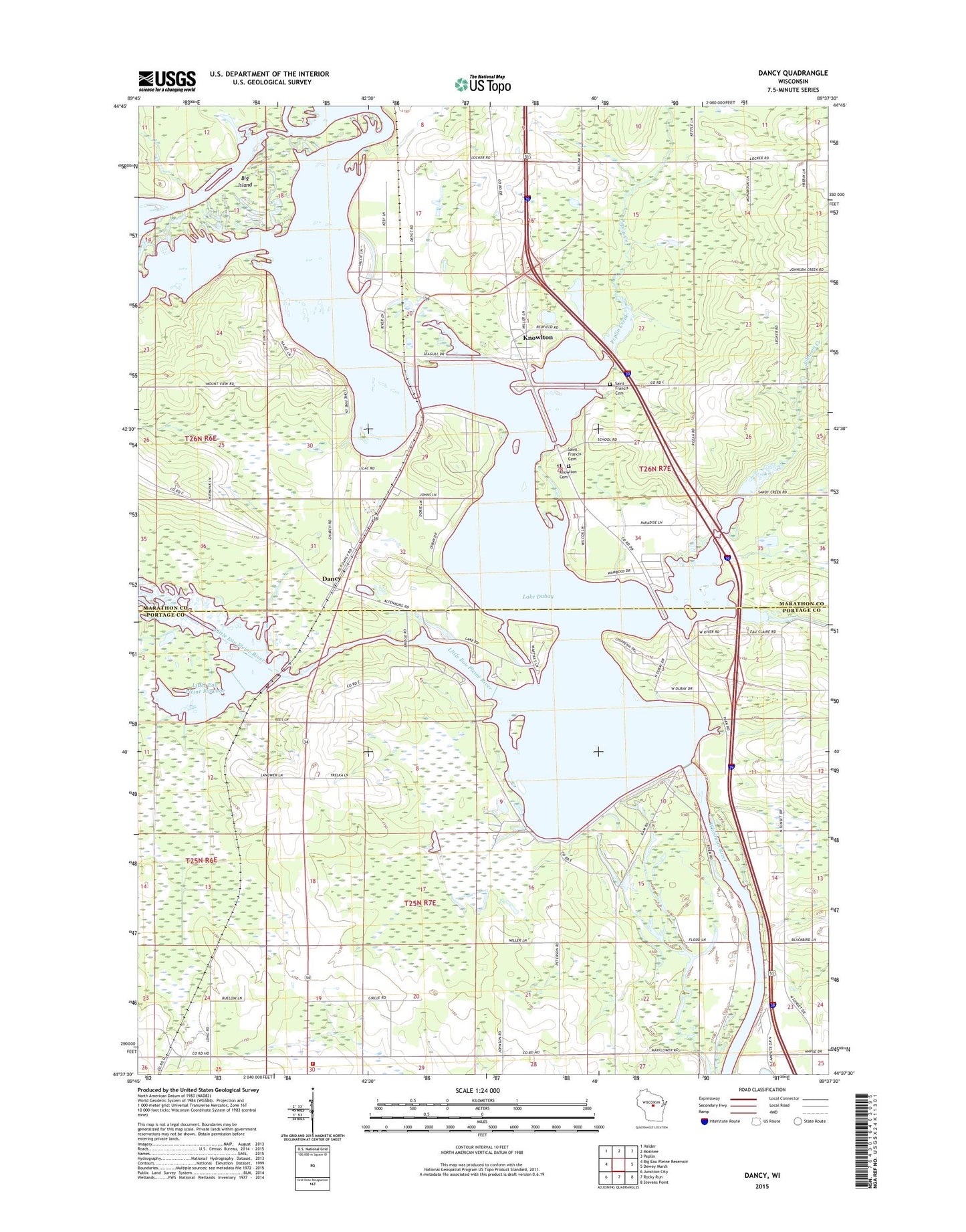
2022 topographic map quadrangle Dancy in the state of Wisconsin. Scale: 1:24000. Based on the newly updated USGS 7.5' US Topo map series, this map is in the following counties: Marathon, Portage. The map contains contour data, water features, and other items you are used to seeing on USGS maps, but also has updated roads and other features. This is the next generation of topographic maps. Printed on high-quality waterproof paper with UV fade-resistant inks.
Quads adjacent to this one:
West: Big Eau Pleine Reservoir
Northwest: Halder
North: Mosinee
Northeast: Peplin
East: Dewey Marsh
Southeast: Stevens Point
South: Rocky Run
Southwest: Junction City
This map covers the same area as the classic USGS quad with code o44089f6.
Contains the following named places: Big Eau Pleine River, Big Island, Dancy, Du Bay Park, Dubay 2 WP 533 Dam, Johnson Creek, Knowlton, Knowlton Cemetery, Knowlton Census Designated Place, Knowlton School, Lake Du Bay, Lake Dubay 4890, Liberty Bell School, Lily School, Little Eau Claire River, Little Eau Pleine Flowage, Little Eau Pleine River, Marion School, Peplin Creek, Rudolph Volunteer Fire Department Station 3, Saint Francis Church, Saint Francis Xavier Cemetery Old, Saint John the Baptist Cemetery, Saint Johns Church, State of Wisconsin, Town of Eau Pleine, Town of Knowlton, Wojdac Farm