MyTopo
Pike Lake NW Wisconsin US Topo Map
Couldn't load pickup availability
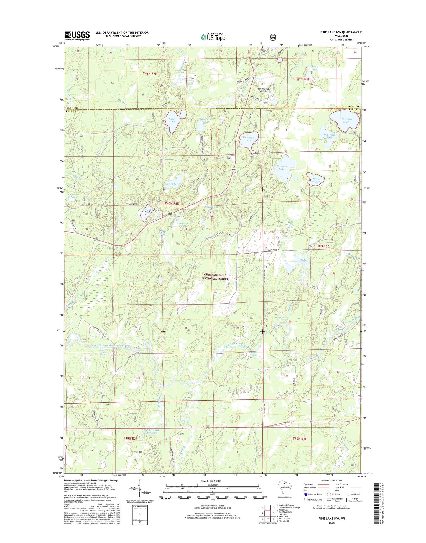
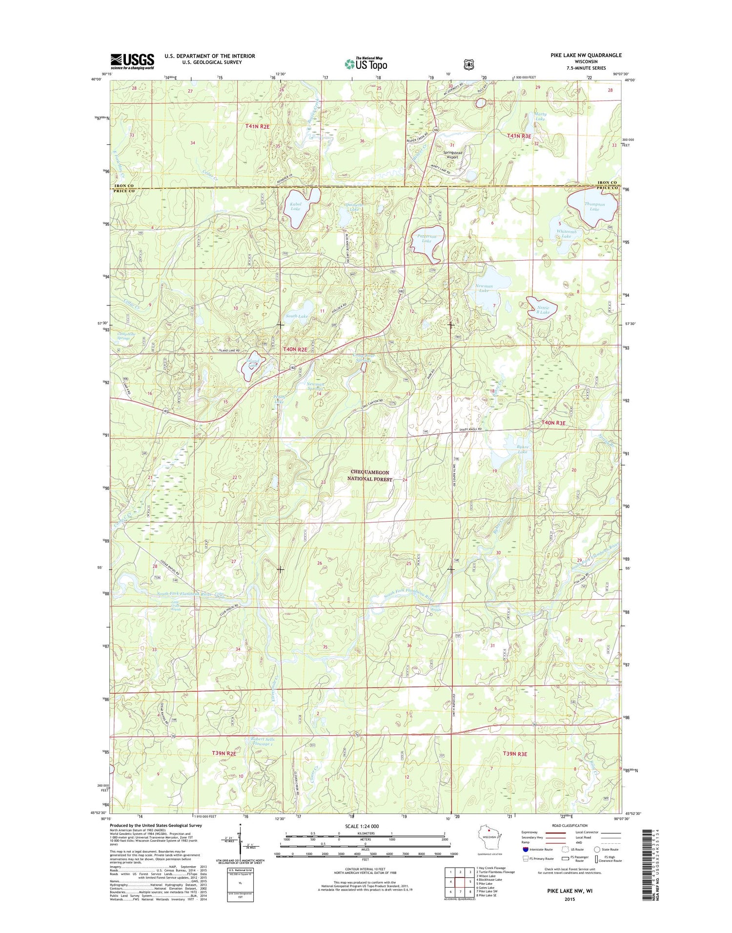
2018 topographic map quadrangle Pike Lake NW in the state of Wisconsin. Scale: 1:24000. Based on the newly updated USGS 7.5' US Topo map series, this map is in the following counties: Price, Iron. The map contains contour data, water features, and other items you are used to seeing on USGS maps, but also has updated roads and other features. This is the next generation of topographic maps. Printed on high-quality waterproof paper with UV fade-resistant inks.
Quads adjacent to this one:
West: Blockhouse Lake
Northwest: Hay Creek Flowage
North: Turtle-Flambeau Flowage
Northeast: Wilson Lake
East: Pike Lake
Southeast: Pike Lake SE
South: Pike Lake SW
Southwest: Gates Lake
Contains the following named places: Beaver Creek, Byhre Creek, Byhre Lake, Camp C Creek, Camp Four Springs, Camp Nine Springs, Cedar Rapids, Clover Creek, Elevenmile Creek, Island Lake, Kabol Lake, Little Cedar Rapids, Marty Lake, Nettie B Lake, Newman Creek, Newman Lake, Newman Lake Recreation Area, Newman Springs, Newman Springs Ski Trail, Patterson Lake, Penny Lake, Quimette Lake, Riley Creek, Riley Creek Forest Service Station, Robert Sells 3WR814 Dam, Robert Sells Flowage 1, Shady Knoll School, Smith Rapids, Smith River Campground, South Fork Fire Tower, South Lake, Springstead Airport, Thompson Lake, Whitcomb Lake