MyTopo
Blockhouse Lake Wisconsin US Topo Map
Couldn't load pickup availability
Also explore the Blockhouse Lake Forest Service Topo of this same quad for updated USFS data
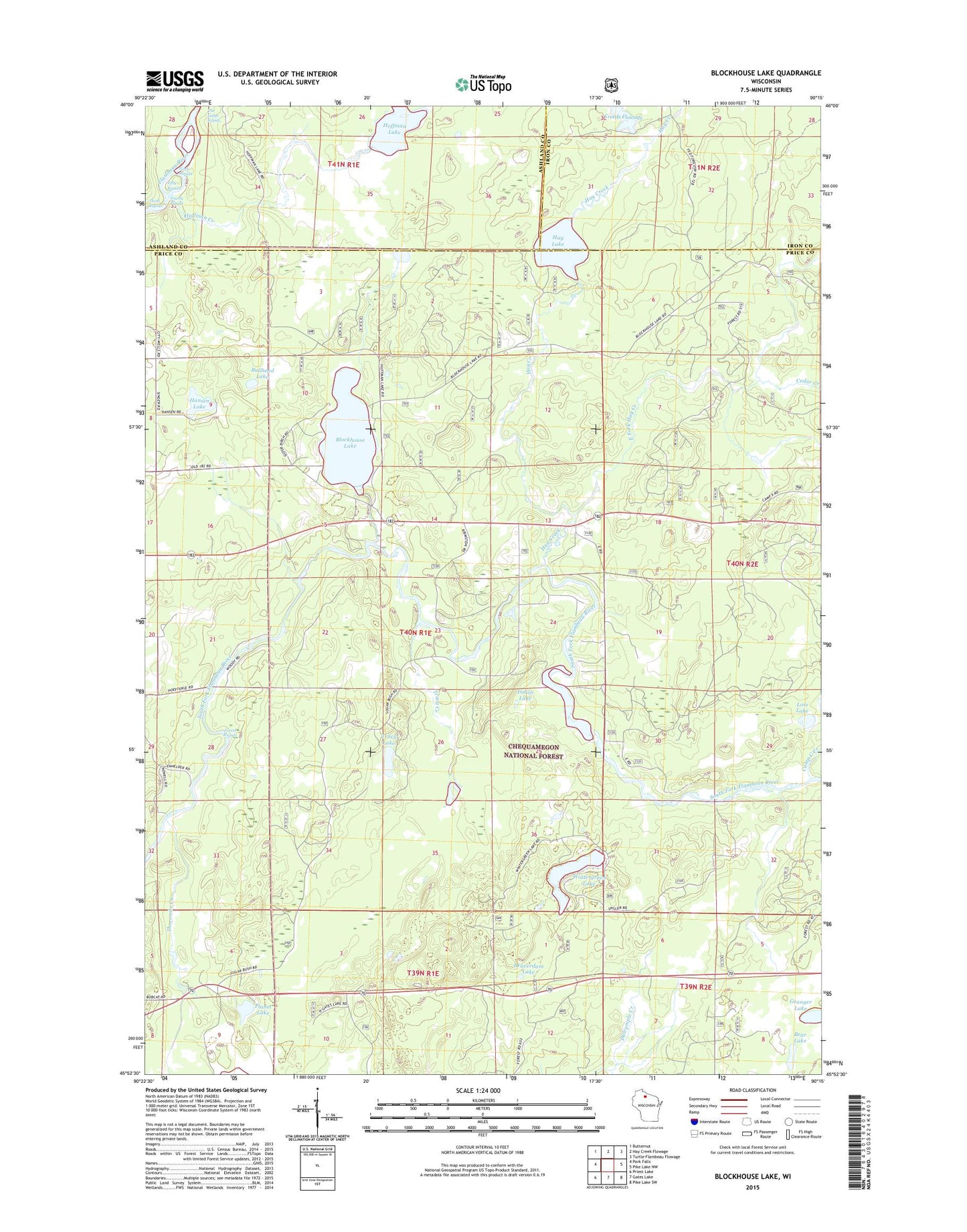
2022 topographic map quadrangle Blockhouse Lake in the state of Wisconsin. Scale: 1:24000. Based on the newly updated USGS 7.5' US Topo map series, this map is in the following counties: Price, Ashland, Iron. The map contains contour data, water features, and other items you are used to seeing on USGS maps, but also has updated roads and other features. This is the next generation of topographic maps. Printed on high-quality waterproof paper with UV fade-resistant inks.
Quads adjacent to this one:
West: Park Falls
Northwest: Butternut
North: Hay Creek Flowage
Northeast: Turtle-Flambeau Flowage
East: Pike Lake NW
Southeast: Pike Lake SW
South: Gates Lake
Southwest: Priest Lake
This map covers the same area as the classic USGS quad with code o45090h3.
Contains the following named places: Bear Lake, Beaverdam Lake, Blockhouse Lake, Bullhead Lake, Cedar Creek, Creeds Flowage, East Fork Hay Creek, Fifield Lookout Tower, Fifth Rapids, Forest Rapids, Fourth Rapids, Granger Lake, Hansen Lake, Hay Creek, Hay Creek Hoffman Lake State Wildlife Area, Hay Lake, Hoffman Creek, Hoffman Lake, Iodine Lake, Lost Lake, Pershing School, Planet Lake, Sixth Rapids, Sugarbush Dam, Sugarbush School, The Ledge Rapids, Third Rapids, Threemile Creek, Town of Eisenstein, Tracy Creek, Tracy Lake, WHBM-FM (Park Falls), Wintergreen Lake, WLEF-TV (Park Falls), ZIP Code: 54552