MyTopo
Powell Wisconsin US Topo Map
Couldn't load pickup availability
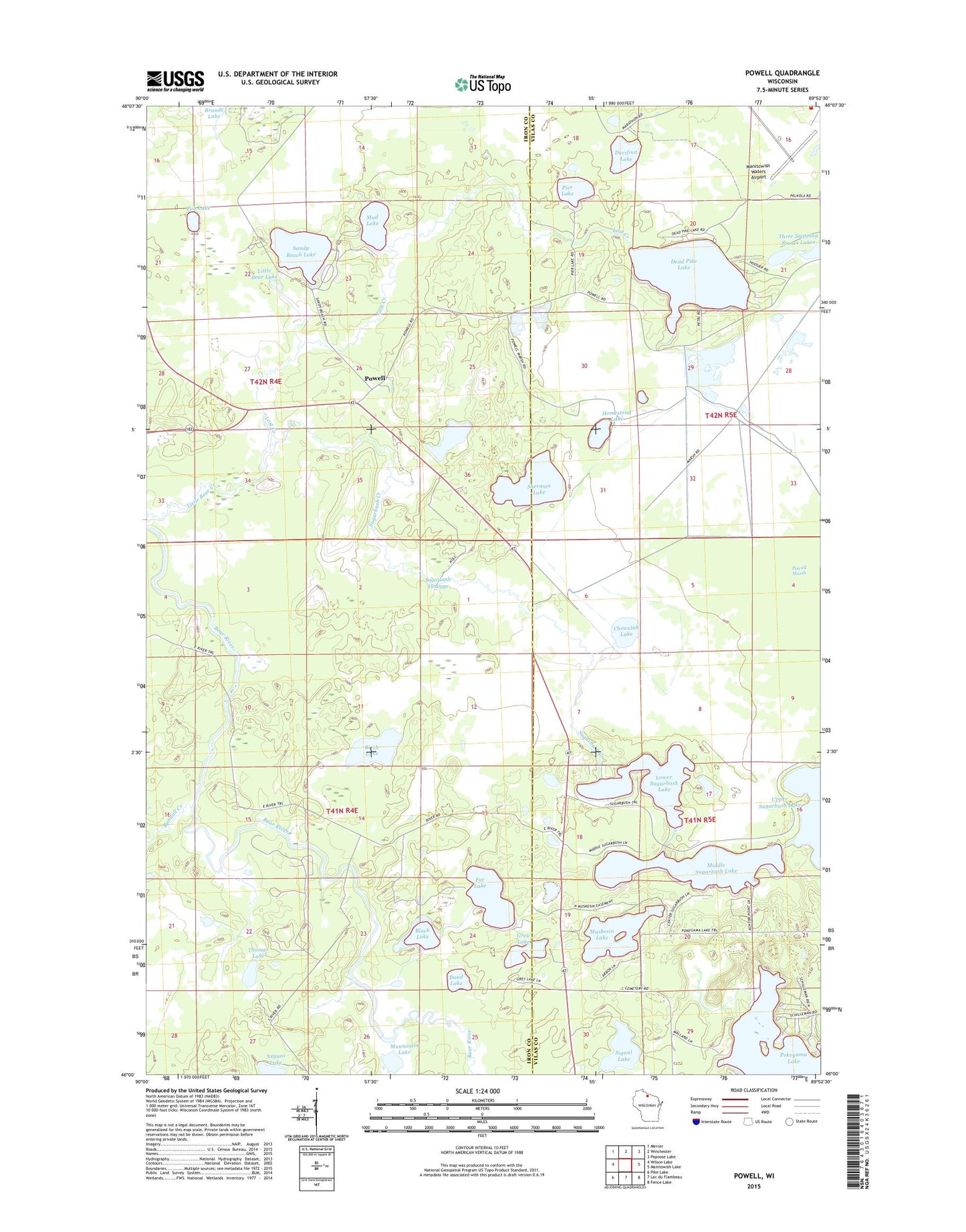
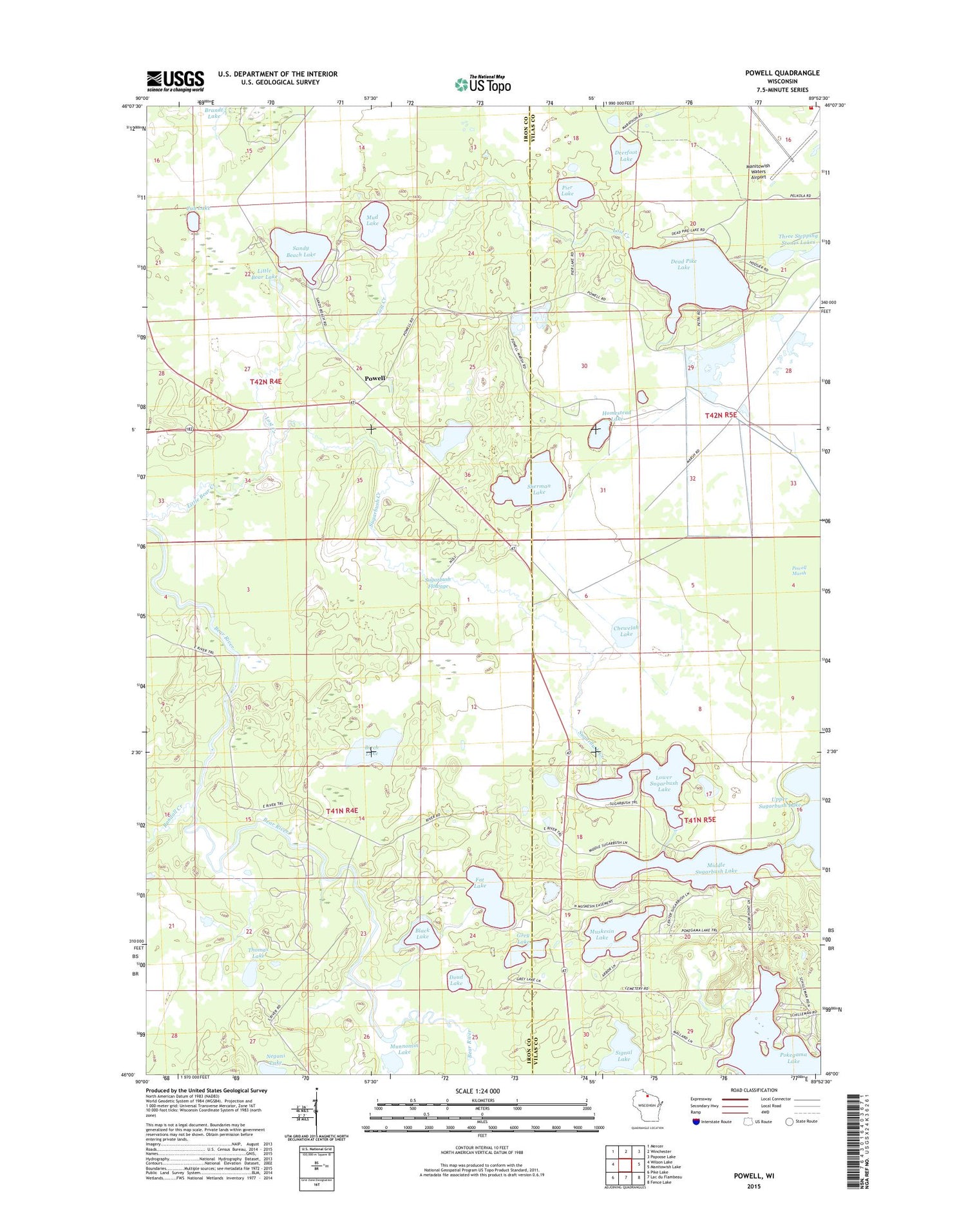
2018 topographic map quadrangle Powell in the state of Wisconsin. Scale: 1:24000. Based on the newly updated USGS 7.5' US Topo map series, this map is in the following counties: Iron, Vilas. The map contains contour data, water features, and other items you are used to seeing on USGS maps, but also has updated roads and other features. This is the next generation of topographic maps. Printed on high-quality waterproof paper with UV fade-resistant inks.
Quads adjacent to this one:
West: Wilson Lake
Northwest: Mercer
North: Winchester
Northeast: Papoose Lake
East: Manitowish Lake
Southeast: Fence Lake
South: Lac du Flambeau
Southwest: Pike Lake
Contains the following named places: Birch Lake, Black Lake, Chewelah Lake, Cub Lake, Dead Pike Lake, Deerfoot Lake, Doud Lake, Fat Lake, Grey Lake, Homestead Lake, Little Bear Lake, Lost Creek, Lower Sugarbush Lake, Manitowish Waters Airport, Manitowish Waters Fire Company, Middle Sugarbush Lake, Mud Lake, Munnomin Lake, Muskesin Lake, Negani Lake, Pier Lake, Powell, Powell Marsh, Powell Marsh State Public Hunting Grounds, Randall Creek, Sandy Beach Lake, Sherman Lake, Signal Lake, Stepping Stone Lake Number 2, Stepping Stone Lake Number 3, Sugarbush Creek, Sugarbush Flowage, Thomas Lake, Three Stepping Stones Lakes, Upper Sugarbush Lake