MyTopo
Mercer Wisconsin US Topo Map
Couldn't load pickup availability
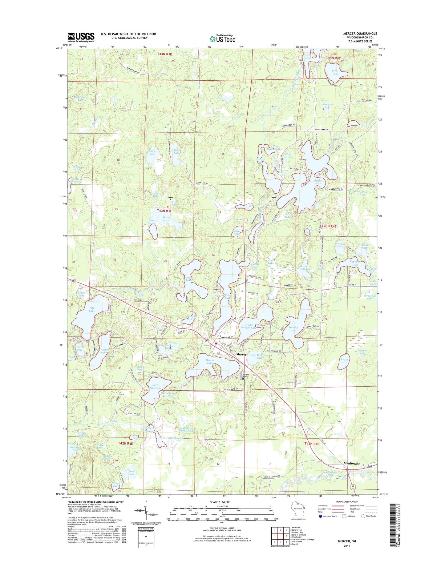
2022 topographic map quadrangle Mercer in the state of Wisconsin. Scale: 1:24000. Based on the newly updated USGS 7.5' US Topo map series, this map is in the following counties: Iron. The map contains contour data, water features, and other items you are used to seeing on USGS maps, but also has updated roads and other features. This is the next generation of topographic maps. Printed on high-quality waterproof paper with UV fade-resistant inks.
Quads adjacent to this one:
West: Lake of the Falls
Northwest: Pine Lake
North: Lake Evelyn
Northeast: Chaney Lake
East: Winchester
Southeast: Powell
South: Wilson Lake
Southwest: Turtle-Flambeau Flowage
This map covers the same area as the classic USGS quad with code o46090b1.
Contains the following named places: Bear Lake, Bluegill Lake, Brandt Lake, Brush Lake, Carow Park, Charles Lake, Cille Lake, Clear Lake, Courtland Lake, Cramer Lake, Crystal Lake, Deer Lake, Deertail Lake, Echo Lake, Evelyn Creek, Feely Lake, Fierek Lake, Flannagan Lake, Gerlock Lake, Geyser Lake, Grand Portage Lake, Harper Lake, Hazel Lake, Hobbs Lake, Jankewitz Lake, July Lake, June Lake, Kinder Lake, Krupka Lake, Lac de Beaumont, Lake Tahoe, Little Martha Lake, Little Oxbow Lake, Little Pike Lake, Little Turtle Flowage, Little Turtle River 3WR858 Dam, Little Turtle River Flowage, Long Lake Creek, Manitowish, Margaret Lake, Martha Lake, May Lake, Mercer, Mercer Area Ambulance and Rescue, Mercer Cemetery, Mercer Census Designated Place, Mercer Environmental Tourism Charter School, Mercer Fire Department Station 1, Mercer Lake, Mercer Lookout Tower, Mercer Post Office, Mercer Public School, Net Lake, One Man Lake, Oxbow Lake, Paul Lake, Payment Lake, Pike Lake, Plantation Lake, Rice Lake, San Domingo Lake, Sells Lake, Smith Lake, Spider Lake, Spring Lake, Twin Lake, Viola Lake, Voss Lake, ZIP Code: 54547