MyTopo
Rewey Wisconsin US Topo Map
Couldn't load pickup availability
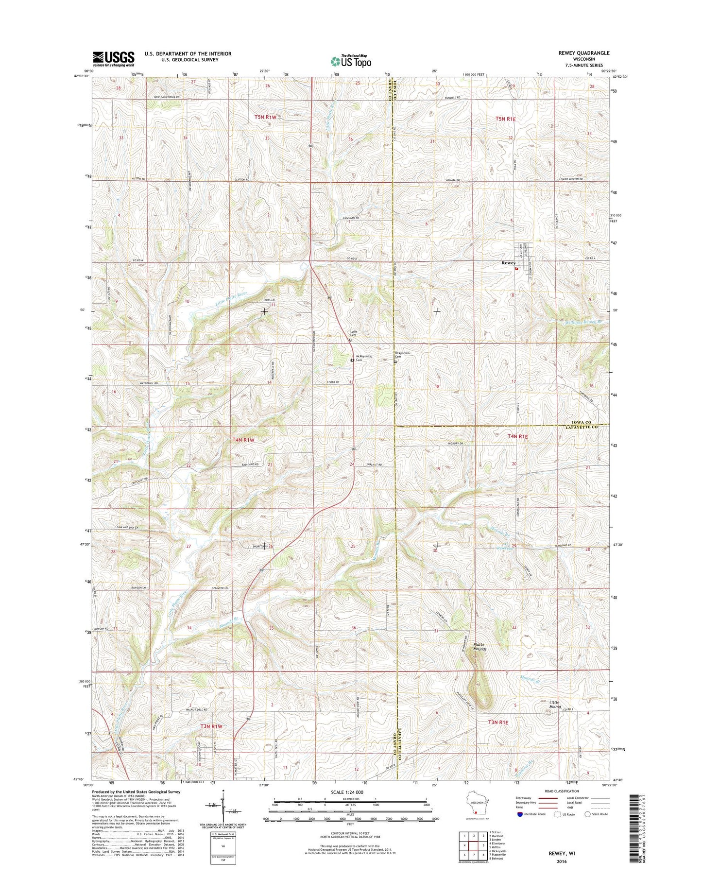
2018 topographic map quadrangle Rewey in the state of Wisconsin. Scale: 1:24000. Based on the newly updated USGS 7.5' US Topo map series, this map is in the following counties: Grant, Lafayette, Iowa. The map contains contour data, water features, and other items you are used to seeing on USGS maps, but also has updated roads and other features. This is the next generation of topographic maps. Printed on high-quality waterproof paper with UV fade-resistant inks.
Quads adjacent to this one:
West: Ellenboro
Northwest: Stitzer
North: Montfort
Northeast: Linden
East: Mifflin
Southeast: Belmont
South: Platteville
Southwest: Dickeyville
Contains the following named places: .43 Reservoir, 0.49 Reservoir, 53580, Arthur, Austin Farms, Bear Branch, Bent Stream Valley Farms, Carpenter School, Grant School, Greenwood School, Hazel Dell School, John Gobracht G-6513 Dam, Kirkpatrick Cemetery, Klein G1349.1 Dam, Little Mound, McReynolds Cemetery, Mound Valley School, Mounds Branch, Nip and Tuck Cemetery, Platte Mounds, Rewey, Rewey Fire Department, Rewey Post Office, Rock School, Runde Dairy Farm, Runde Farms, Seng Farms, Spensley Farms, Sunny Dale School, Town of Lima, Village of Rewey, Walnut Grove School, West Mound School