MyTopo
Somerset South Wisconsin US Topo Map
Couldn't load pickup availability
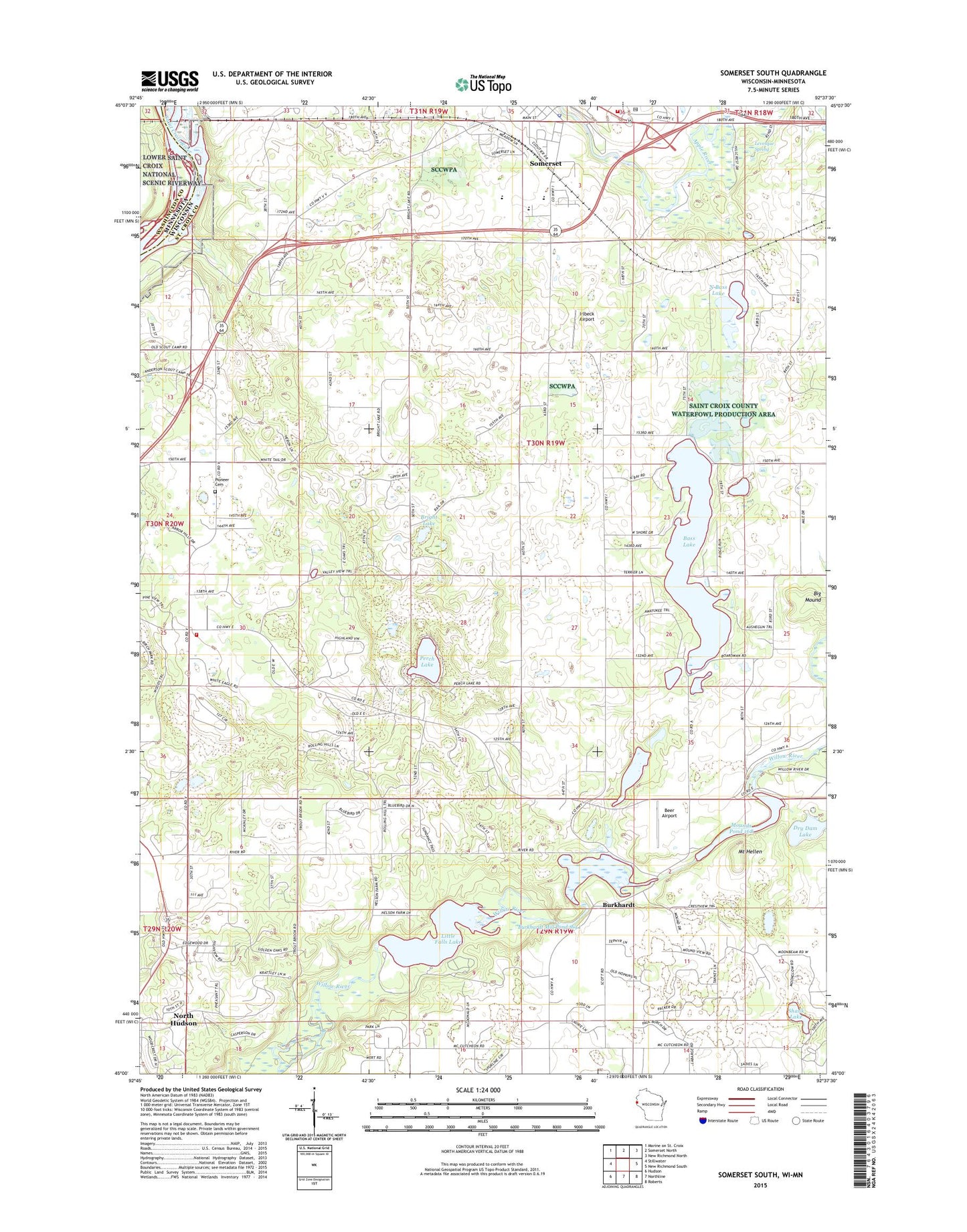
2019 topographic map quadrangle Somerset South in the state of Wisconsin. Scale: 1:24000. Based on the newly updated USGS 7.5' US Topo map series, this map is in the following counties: St. Croix, Washington. The map contains contour data, water features, and other items you are used to seeing on USGS maps, but also has updated roads and other features. This is the next generation of topographic maps. Printed on high-quality waterproof paper with UV fade-resistant inks.
Quads adjacent to this one:
West: Stillwater
North: Somerset North
Northeast: New Richmond North
East: New Richmond South
Southeast: Roberts
South: Northline
Southwest: Hudson
Contains the following named places: Bass Lake, Beer Airport, Big Mound, Birch Park Ski Area, Bright Lake, Burkhardt, Burkhardt Station, Dry Dam Lake, Elm Park School, Emanuel Church, Fairview School, Floaters Haven Park, Four Corners School, Hudson Townhall, Irlbeck Airport, Landing Hill School, Levesque Spring, Little Falls Dam, Little Falls Lake, McKinley School, Mill Pond, Mound Plant WP 224 Dam, Mounds Pond, Mount Hellen, North Bass Lake, North Bass Lake School, Perch Lake, Pioneer Cemetery, Saint Joseph Fire Department, Saint Joseph Townhall, Shank Lake, Snow Crest Ski Area, Somerset, Somerset Elementary School, Somerset Fire / Rescue, Somerset High School, Somerset Middle School, Somerset Police Department, Somerset Post Office, Town of Saint Joseph, Willow Falls WP 195 Dam, Willow River State Park, ZIP Code: 54082