MyTopo
Northline Wisconsin US Topo Map
Couldn't load pickup availability
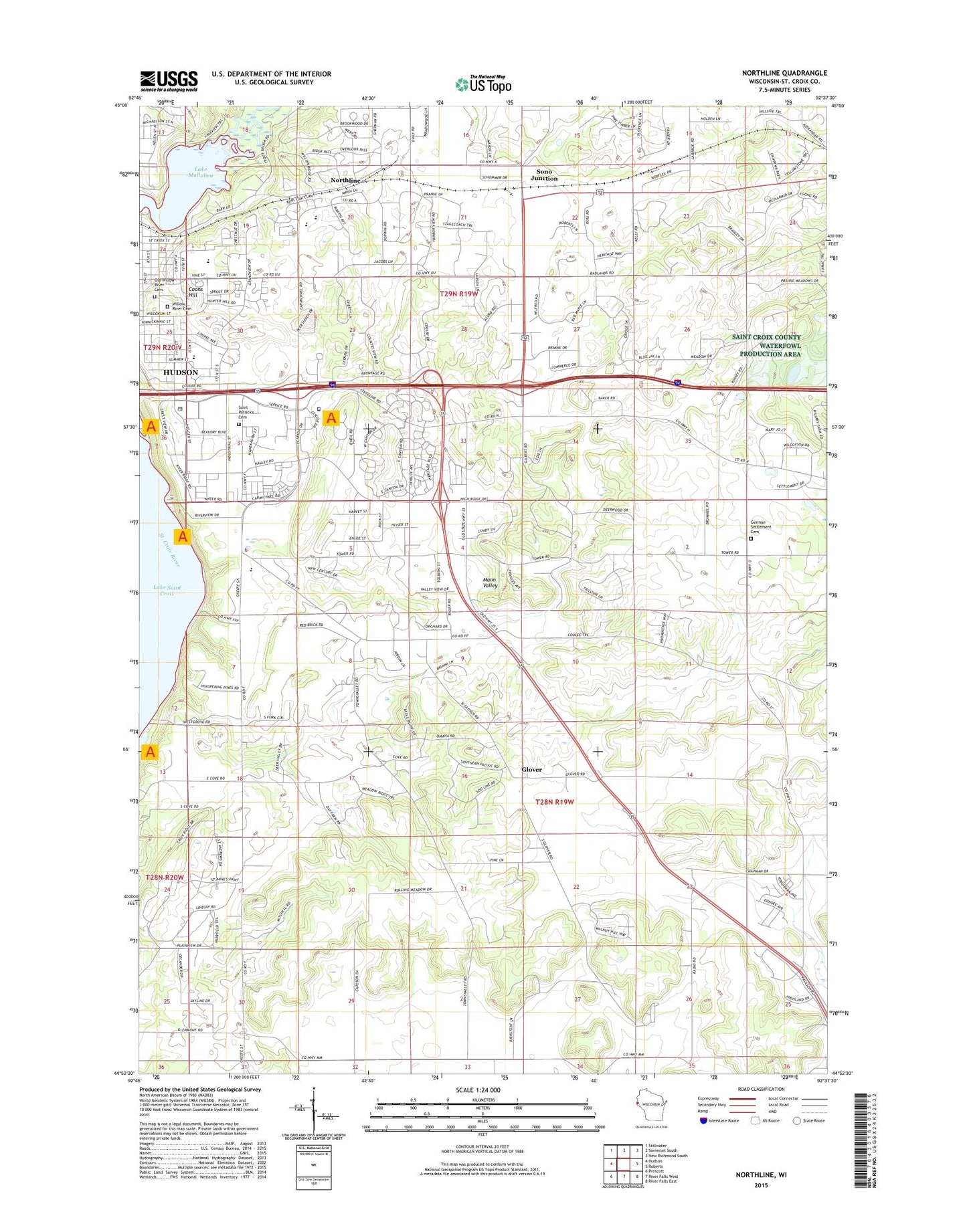
2022 topographic map quadrangle Northline in the state of Wisconsin. Scale: 1:24000. Based on the newly updated USGS 7.5' US Topo map series, this map is in the following counties: St. Croix. The map contains contour data, water features, and other items you are used to seeing on USGS maps, but also has updated roads and other features. This is the next generation of topographic maps. Printed on high-quality waterproof paper with UV fade-resistant inks.
Quads adjacent to this one:
West: Hudson
Northwest: Stillwater
North: Somerset South
Northeast: New Richmond South
East: Roberts
Southeast: River Falls East
South: River Falls West
Southwest: Prescott
This map covers the same area as the classic USGS quad with code o44092h6.
Contains the following named places: Burton Field, City of Hudson, Clover Lawn School, Coons Hill, E P Rock Elementary School, Eagle Woods Park, Fox Mobile Home Park, German Settlement Cemetery, Glen Mont School, Glover, Glover Station School, Hudson Country Club, Hudson Fire Department, Hudson High School, Hudson Hospital and Clinic, Hudson Junior High School, Hudson Middle School, Hudson Post Office, Hudson Prairie Elementary School, Lake Mallalieu, Mann Valley School, Midway School, Mount Zion Lutheran Church, Northline, Oak Ridge School, Old Willow River Cemetery, Pleasant View School, Prairie Lawn School, River Crest Elementary School, River Falls Police Department, Saint Croix County Sheriff's Office, Saint Patrick's Cemetery, Sono Junction, Sunny Lawn School, Town of Hudson, Town of Troy, Troy Park, Troy Townhall, University of Wisconsin Farm, Webster Park, WEVR-AM (River Falls), WEVR-FM (River Falls), Williams Park, Willow River Cemetery, WRFW-FM (River Falls), WRPX-AM (Hudson), ZIP Code: 54016