MyTopo
Somerset North Wisconsin US Topo Map
Couldn't load pickup availability
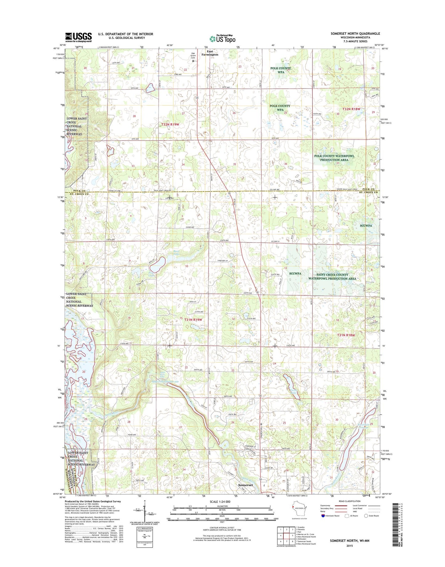
2022 topographic map quadrangle Somerset North in the state of Wisconsin. Scale: 1:24000. Based on the newly updated USGS 7.5' US Topo map series, this map is in the following counties: St. Croix, Polk, Washington. The map contains contour data, water features, and other items you are used to seeing on USGS maps, but also has updated roads and other features. This is the next generation of topographic maps. Printed on high-quality waterproof paper with UV fade-resistant inks.
Quads adjacent to this one:
Northwest: Scandia
North: Osceola
Northeast: Nye
East: New Richmond North
Southeast: New Richmond South
South: Somerset South
Southwest: Stillwater
This map covers the same area as the classic USGS quad with code o45092b6.
Contains the following named places: Apple Falls Flowage, Apple River, Apple River Canyon State Natural Area, Apple River Falls, Apple River Falls D 64.5 Dam, Apple River Generating Station, Apple River School, Bass Lake, Christ Lutheran Church, Country View Court, Lakeside School, Oak Grove Cemetery, Oak Knoll School, Oak Lawn School, Pine Lake, Riverdale Dam, Riverdale Flowage, Riverdale School, Saint Anne Catholic School, Saint Annes Catholic Church, Saint Croix Islands State Wildlife Area, Sand Hill School, Town of Somerset, Traisers Homestead Farm, Turtle Lake, Village of Somerset, ZIP Code: 54025