MyTopo
Spider Island Wisconsin US Topo Map
Couldn't load pickup availability
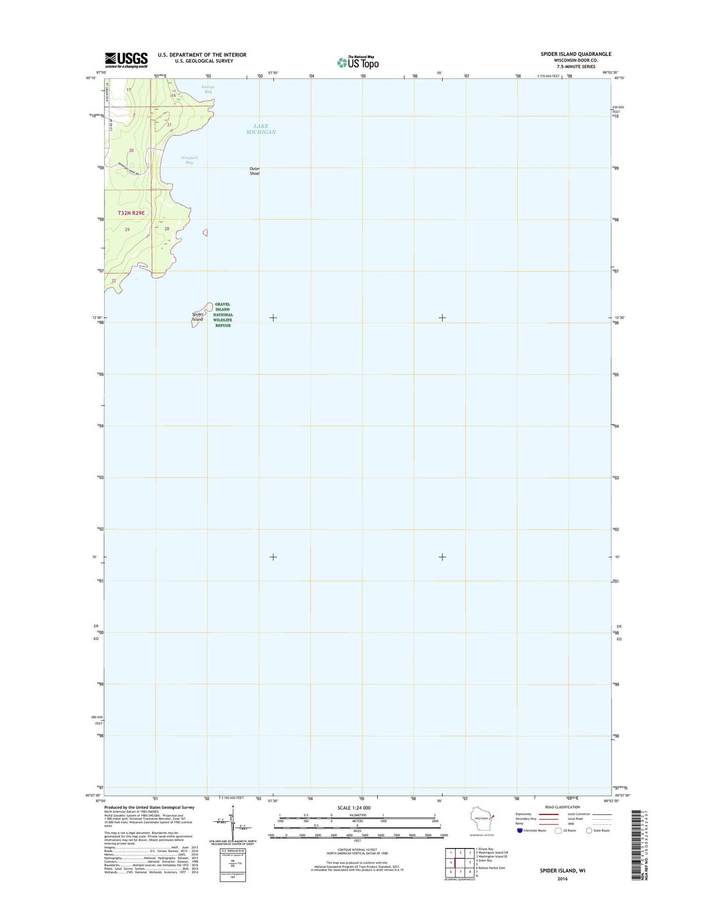
2018 topographic map quadrangle Spider Island in the state of Wisconsin. Scale: 1:24000. Based on the newly updated USGS 7.5' US Topo map series, this map is in the following counties: Door. The map contains contour data, water features, and other items you are used to seeing on USGS maps, but also has updated roads and other features. This is the next generation of topographic maps. Printed on high-quality waterproof paper with UV fade-resistant inks.
Quads adjacent to this one:
West: Sister Bay
Northwest: Ellison Bay
North: Washington Island SW
Northeast: Washington Island SE
Southwest: Baileys Harbor East
Contains the following named places: Gravel Island National Wildlife Refuge, Newport Bay, Newport Conifer-Hardwoods State Natural Area, Newport State Park, Outer Shoal, Spider Island, Wisconsin Islands Wilderness (Gravel Island Refuge)