MyTopo
Washington Island SW Wisconsin US Topo Map
Couldn't load pickup availability
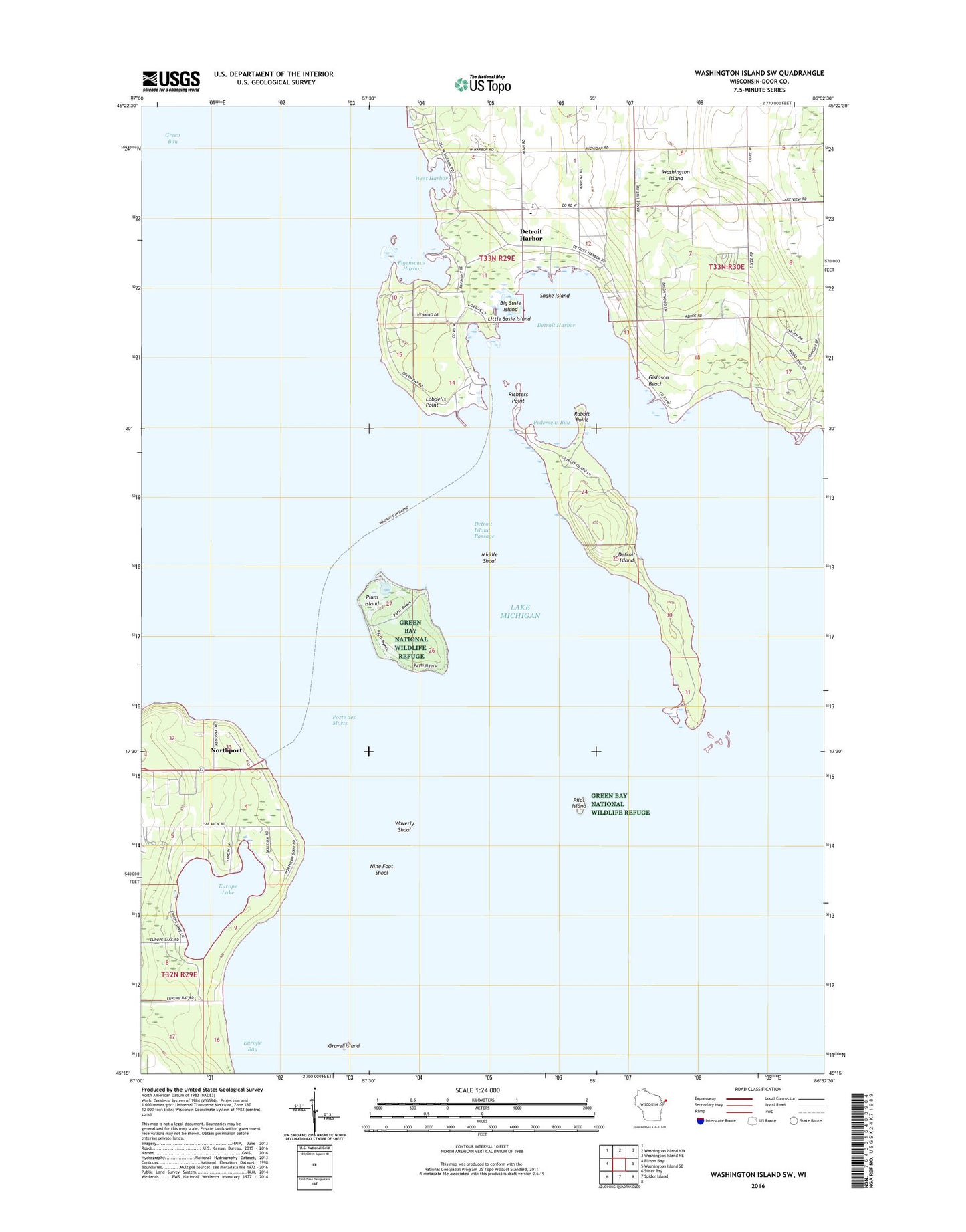
2022 topographic map quadrangle Washington Island SW in the state of Wisconsin. Scale: 1:24000. Based on the newly updated USGS 7.5' US Topo map series, this map is in the following counties: Door. The map contains contour data, water features, and other items you are used to seeing on USGS maps, but also has updated roads and other features. This is the next generation of topographic maps. Printed on high-quality waterproof paper with UV fade-resistant inks.
Quads adjacent to this one:
West: Ellison Bay
North: Washington Island NW
Northeast: Washington Island NE
East: Washington Island SE
South: Spider Island
Southwest: Sister Bay
This map covers the same area as the classic USGS quad with code o45086c8.
Contains the following named places: Big Susie Island, Detroit Harbor, Detroit Harbor State Natural Area, Detroit Island, Detroit Island Passage, Door County Library Washington Island Branch, East Channel, Europe Bay, Europe Bay Woods State Natural Area, Europe Lake, Ferdinand Hotz Park, Figenscaus Harbor, Gislason Beach, Gravel Island, Kenosha Park, Little Susie Island, Lobdells Point, Maple Grove Golf Course, Middle Shoal, Nine Foot Shoal, Northport, Pedersens Bay, Pilot Island, Pilot Island Light, Plum Island, Plum Light Range Lights, Porte des Morts, Rabbit Point, Richters Point, Rocky Ridge Farm, Sand Dunes Park, Shipyard Island Marina-Multiple Lifting Facilities, Snake Island, Washington Island Elementary School, Washington Island Police Department, Washington Island Post Office, Washington Island School, Waverly Shoal, West Channel, West Harbor, Windflower Farm, ZIP Code: 54246