MyTopo
Baileys Harbor East Wisconsin US Topo Map
Couldn't load pickup availability
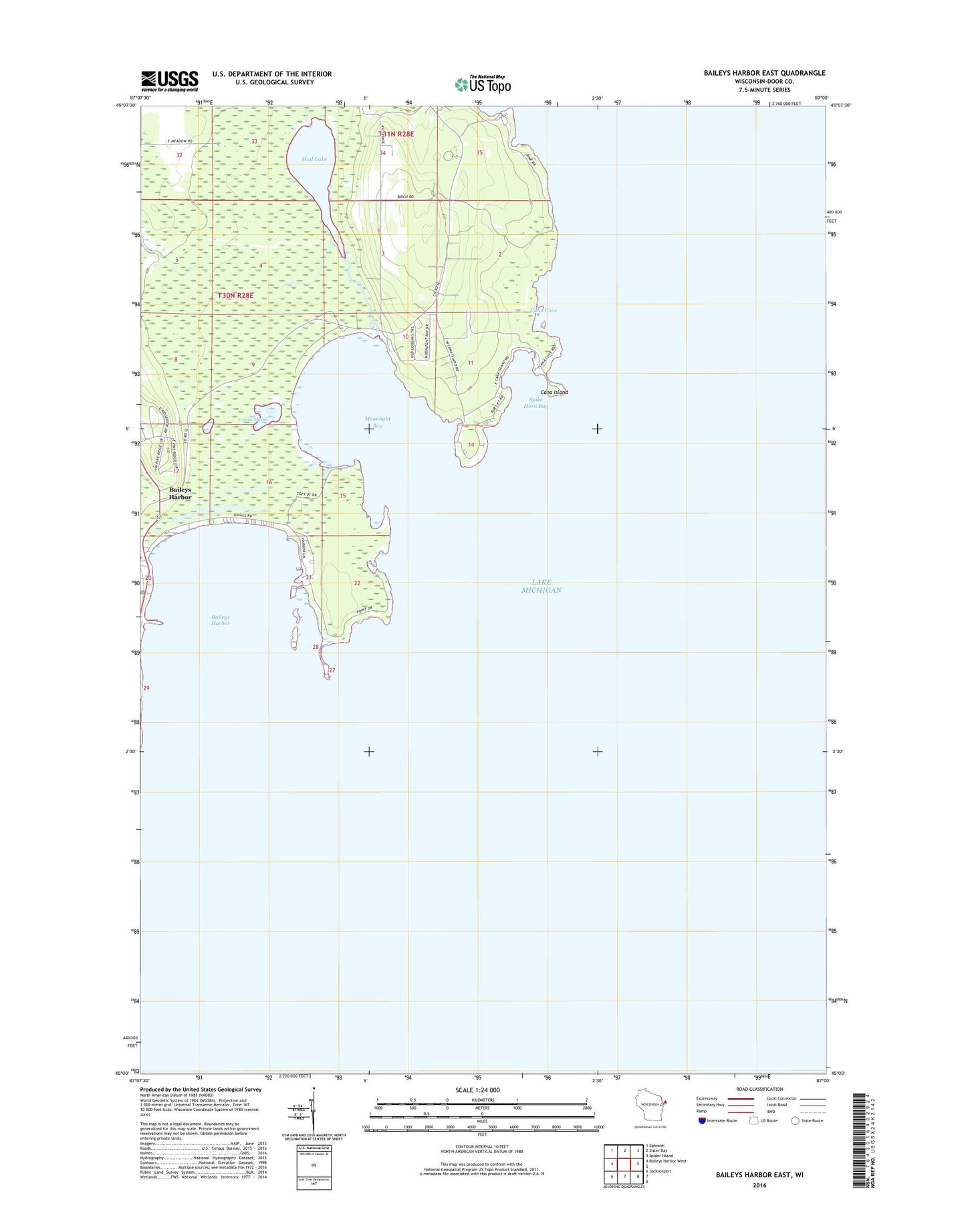
2022 topographic map quadrangle Baileys Harbor East in the state of Wisconsin. Scale: 1:24000. Based on the newly updated USGS 7.5' US Topo map series, this map is in the following counties: Door. The map contains contour data, water features, and other items you are used to seeing on USGS maps, but also has updated roads and other features. This is the next generation of topographic maps. Printed on high-quality waterproof paper with UV fade-resistant inks.
Quads adjacent to this one:
West: Baileys Harbor West
Northwest: Ephraim
North: Sister Bay
Northeast: Spider Island
Southwest: Jacksonport
This map covers the same area as the classic USGS quad with code o45087a1.
Contains the following named places: Anclam Park, Baileys Harbor, Bailey's Harbor Boreal Forest And Wetlands State Natural Area, Baileys Harbor Post Office, Baileys Harbor Ridges Park, Baileys Harbor Yacht Club Incorporated, Cana Cove, Cana Island, Cana Island Light, Door County, Door County Library McArdle Branch, Moonlight Bay, Moonlight Bay Bedrock Beach State Natural Area, Mud Lake, Mud Lake State Natural Area, Mud Lake State Wildlife Area, Rieboldt Creek, Spike Horn Bay, The Ridges Sanctuary State Natural Area, Toft Point State Natural Area, Voecks Marsh