
MyTopo
Stangelville Wisconsin US Topo Map
Couldn't load pickup availability
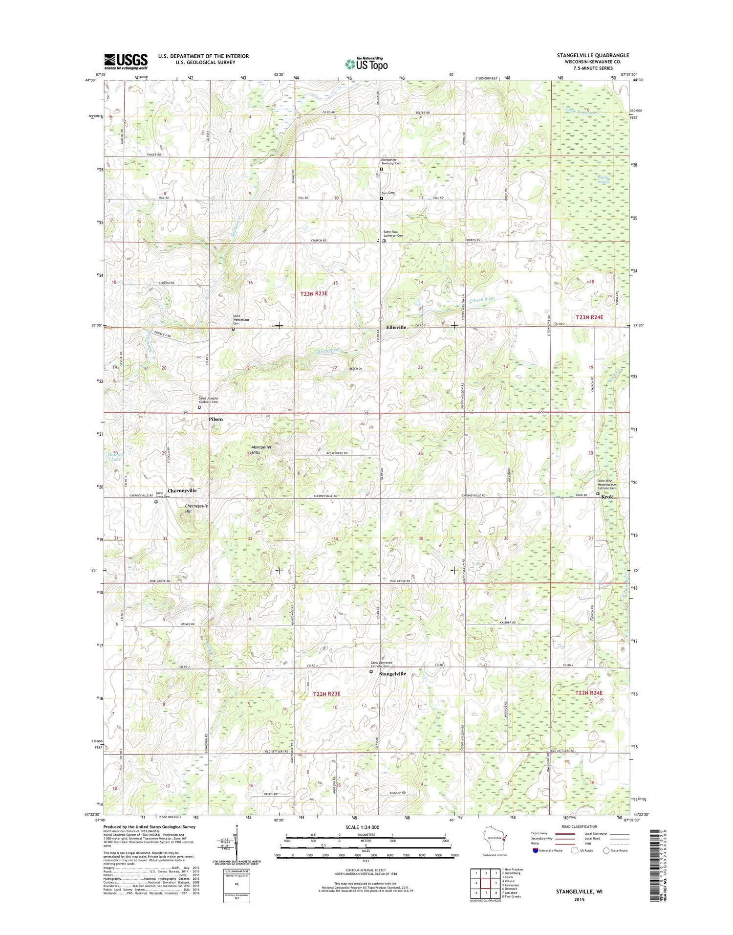
2018 topographic map quadrangle Stangelville in the state of Wisconsin. Scale: 1:24000. Based on the newly updated USGS 7.5' US Topo map series, this map is in the following counties: Kewaunee. The map contains contour data, water features, and other items you are used to seeing on USGS maps, but also has updated roads and other features. This is the next generation of topographic maps. Printed on high-quality waterproof paper with UV fade-resistant inks.
Quads adjacent to this one:
West: Poland
Northwest: New Franken
North: Luxemburg
Northeast: Casco
East: Kewaunee
Southeast: Two Creeks
South: Larrabee
Southwest: Denmark
Contains the following named places: Beech Grove School, Chernesville School, Cherneyville, Cherneyville Hill, Chervenka Farms, Ellisville, Fairview Farms, Hallada Lake, High Bluff School, Jefferson School, Krok, Krok Creek, Lipsky Swamp, Montpelier Hills, Montpelier Township Cemetery, Phillip School, Pilsen, Pilsen School, Rolling Hills Dairy Farm, Saint Anna Cemetery, Saint John Catholic Church, Saint John Nepomucene Cemetery, Saint Joseph Catholic Cemetery, Saint Joseph Catholic Church, Saint Lawrence Catholic Cemetery, Saint Lawrence Catholic Church, Saint Paul Lutheran Cemetery, Saint Paul Lutheran School, Saint Pauls Lutheran Church, Saint Wenceslaus Cemetery, Salzsieder Farms, School Lane Dairy, Stangelville, Town of Montpelier, Valley View Dairy, West Kewaunee United Methodist Church, White Ledge Dairy, Whittier School, Woodland School, Zion Cemetery


