MyTopo
Stockbridge Wisconsin US Topo Map
Couldn't load pickup availability
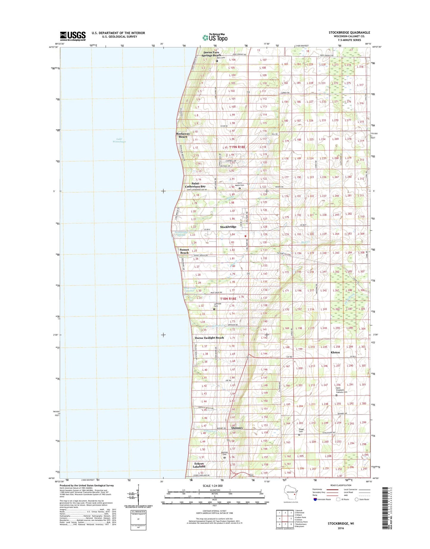
2018 topographic map quadrangle Stockbridge in the state of Wisconsin. Scale: 1:24000. Based on the newly updated USGS 7.5' US Topo map series, this map is in the following counties: Calumet. The map contains contour data, water features, and other items you are used to seeing on USGS maps, but also has updated roads and other features. This is the next generation of topographic maps. Printed on high-quality waterproof paper with UV fade-resistant inks.
Quads adjacent to this one:
West: Indian Point
Northwest: Neenah
North: Sherwood
Northeast: Hilbert
East: Chilton
Southeast: Marytown
South: Brothertown
Southwest: Fahrney Point
Contains the following named places: Dorn Family Cemetery, Dorns Faro Springs Beach, Dorns Twilight Beach, Eckers Lakeland, Gebhart Farm, Indian Cemetery, J and E Quarries, Johnson Creek, Kloten, Kohlman Dairy, Konsin Beach, Lakeside Cemetery, Marquette School, Mill Creek, Mud Creek, Mud Creek Harbor, Pingel Cemetery, Quinney, Quinney Cemetery, Roberts Creek, Rockaway Beach, Saint Catherines Bay, Saint Elizabeth Catholic Cemetery, Saint Elizabeth Church, Saint Mary's Catholic Cemetery, Stockbridge, Stockbridge Elementary School, Stockbridge Fire Department, Stockbridge Harbor, Stockbridge High School, Stockbridge Middle School, Stockbridge Post Office, Sunset Beach, Three Oaks Farm, Town of Stockbridge, Village of Stockbridge, Woelfel Farms, ZIP Code: 53088