MyTopo
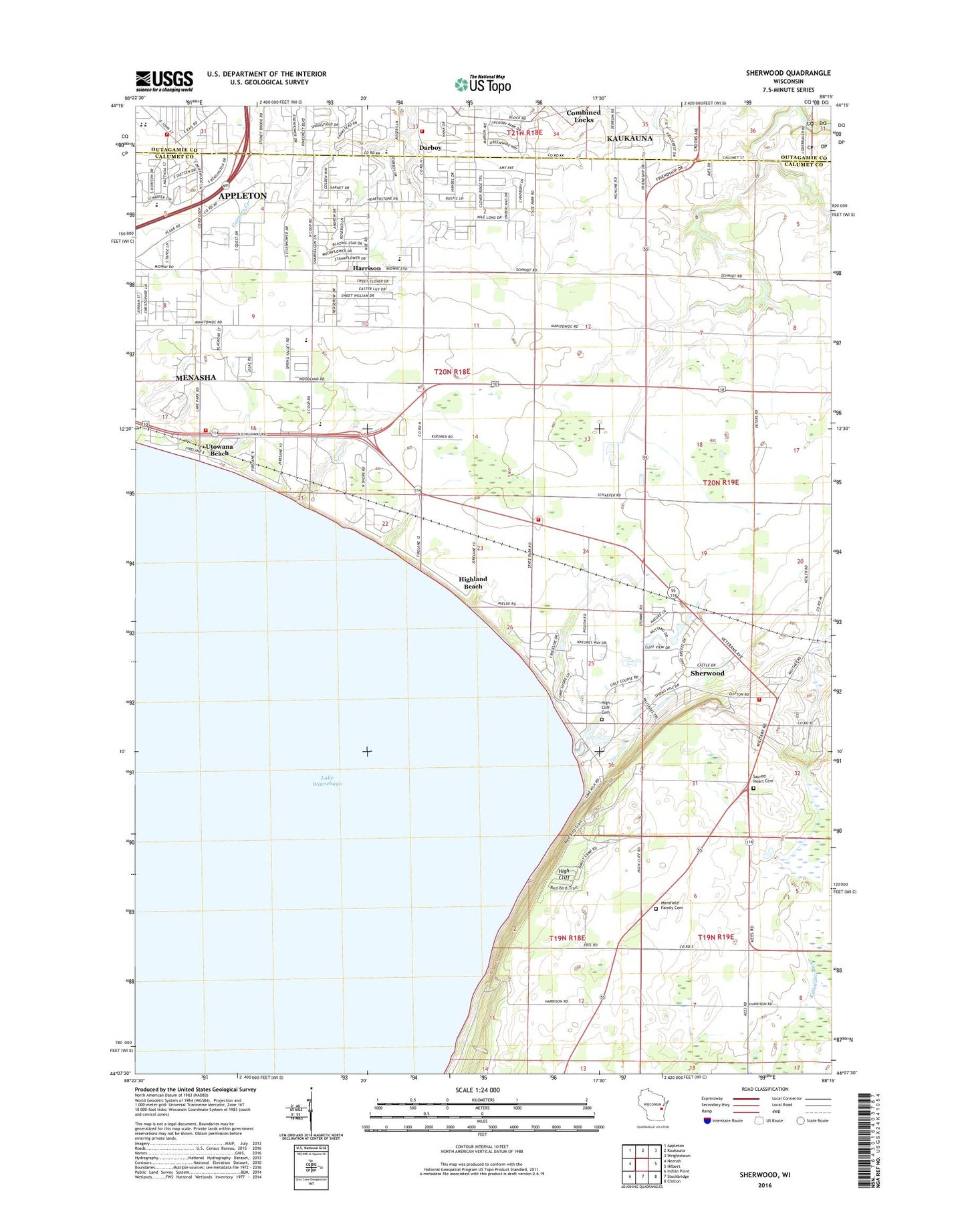
Sherwood Wisconsin US Topo Map
Couldn't load pickup availability
2022 topographic map quadrangle Sherwood in the state of Wisconsin. Scale: 1:24000. Based on the newly updated USGS 7.5' US Topo map series, this map is in the following counties: Calumet, Outagamie. The map contains contour data, water features, and other items you are used to seeing on USGS maps, but also has updated roads and other features. This is the next generation of topographic maps. Printed on high-quality waterproof paper with UV fade-resistant inks.
Quads adjacent to this one:
West: Neenah
Northwest: Appleton
North: Kaukauna
Northeast: Wrightstown
East: Hilbert
Southeast: Chilton
South: Stockbridge
Southwest: Indian Point
This map covers the same area as the classic USGS quad with code o44088b3.
Contains the following named places: Ameri-Milk Farm, Appleton Elementary School, Appleton Fire Department Station 2, Beecher School, Bishop Quarry, Buchanan Volunteer Fire and Rescue Department, Clay School, Darboy, East High School, Everett School, Harrison, Harrison Fire and Rescue Station 70, Harrison Fire Rescue Department, Harrison Volunteer Fire Department Station 1, High Cliff, High Cliff Cemetery, High Cliff Country Club, High Cliff Escarpment State Natural Area, High Cliff Junction, High Cliff State Park, Highland Beach, Holy Spirit Catholic School, Horizons Elementary School, Mansfield Family Cemetery, Mount Cavalry Lutheran School, North Shore Country Club, Sacred Heart Cemetery, Saint John - Sacred Heart School, Shepherd of the Valley Lutheran School, Sherwood, Sherwood Post Office, Sherwood Station, Sunrise Elementary School, Tesla Engineering Charter School, Town of Harrison, Triangle Dairy Farm, Utowana Beach, Village of Harrison, Village of Sherwood, Wisconsin International Raceway, Woodland School, WQWM-AM (Kaukauna), ZIP Codes: 54169, 54915, 54952