MyTopo
Stonebank Wisconsin US Topo Map
Couldn't load pickup availability
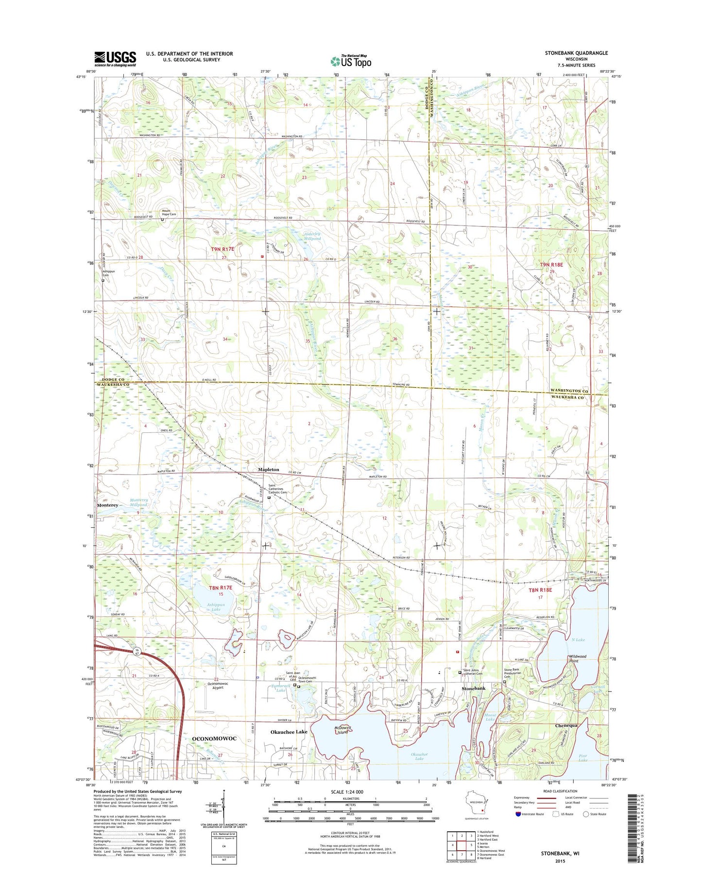
2018 topographic map quadrangle Stonebank in the state of Wisconsin. Scale: 1:24000. Based on the newly updated USGS 7.5' US Topo map series, this map is in the following counties: Waukesha, Dodge, Washington. The map contains contour data, water features, and other items you are used to seeing on USGS maps, but also has updated roads and other features. This is the next generation of topographic maps. Printed on high-quality waterproof paper with UV fade-resistant inks.
Quads adjacent to this one:
West: Ixonia
Northwest: Hustisford
North: Hartford West
Northeast: Hartford East
East: Merton
Southeast: Hartland
South: Oconomowoc East
Southwest: Oconomowoc West
Contains the following named places: Alderley, Alderley Millpond, Alderly Mill 1866c-71 Dam, Ashippun Cemetery, Ashippun Lake, Ashippun Volunteer Fire Department Station 2, Cornell Lake, Crystal Lake, Culleden Farm, Kettle Moraine United Presbyterian Church, Mapleton, Mapleton School, Mason Creek, McDowell Island, Meadow View Elementary School, Monterey, Monterey Dam, Monterey Millpond 34, Moose Lake, Mount Hope Cemetery, North Lake, Oconomowoc Airport, Oconomowoc Cemetery, Oconomowoc Town Police Department, Okauchee Lake 85, Okauchee Lake Census Designated Place, Pleasant View School, Roskopf Farms, Saint Catherine Church, Saint Catherines Catholic Cemetery, Saint Joan of Arc Cemetery, Saint Johns Evangelical Lutheran Church, Saint Johns Lutheran Cemetery, Saint Matthew Lutheran School, Saint Olaf Church, Saint Paul Church, Stone Bank Presbyterian Cemetery, Stone Bank School, Stone Bank Volunteer Fire Department, Stone Ridge Farms, Stonebank, Tamarack Lake, Tamarack School, Town of Ashippun, Town of Oconomowoc, Twilight Farms, Wildwood Point