MyTopo
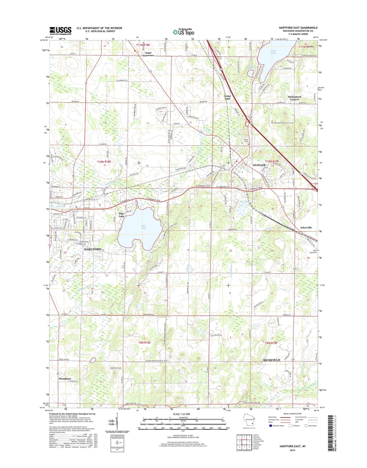
Hartford East Wisconsin US Topo Map
Couldn't load pickup availability
2022 topographic map quadrangle Hartford East in the state of Wisconsin. Scale: 1:24000. Based on the newly updated USGS 7.5' US Topo map series, this map is in the following counties: Washington. The map contains contour data, water features, and other items you are used to seeing on USGS maps, but also has updated roads and other features. This is the next generation of topographic maps. Printed on high-quality waterproof paper with UV fade-resistant inks.
Quads adjacent to this one:
West: Hartford West
Northwest: Nenno
North: Allenton
Northeast: West Bend
East: Jackson
Southeast: Sussex
South: Merton
Southwest: Stonebank
This map covers the same area as the classic USGS quad with code o43088c3.
Contains the following named places: Ackerville, Aurora Medical Center, Becker Farms, Cedar Lake, Diefenbach Corners, Ehmke Farms, Emmanuel Church, Fox Hill, Friess Lake School, Gehring Farms, Gehring View Farms, Hartford Millpond 32, Heartfield Farm, Highland Acres, Kettle Hills Farm, Kratz Farms, Lepien Farview Farm, Log House Farm, Lohr Pond, Mayer Farms, Misty Meadows, Mud Lake, Mueller Lake, Old Saint Peter Cemetery, Pike Lake, Pike Lake 13, Pike Lake 2WP1323 Dam, Pike Lake State Park, Rossman Elementary School, Saint Augustine School, Saint Johns Church, Saint Lawrence, Saint Lawrence Volunteer Fire Department, Saint Paul Little Learners Preschool, Saint Pauls Church, Saint Peter Catholic School, Saint Peters Catholic Church, Schwendimann Farm, Slinger, Slinger Elementary School, Slinger Fire Department, Slinger High School, Slinger Middle School, Slinger Police Department, Slinger Post Office, Slinger Wastewater Treatment Facility, Strupp Dairy Farm, Thompson, Town of Hartford, Union Cemetery, Village of Slinger, Werner Pond, Zuern Farm, ZIP Codes: 53027, 53086