MyTopo
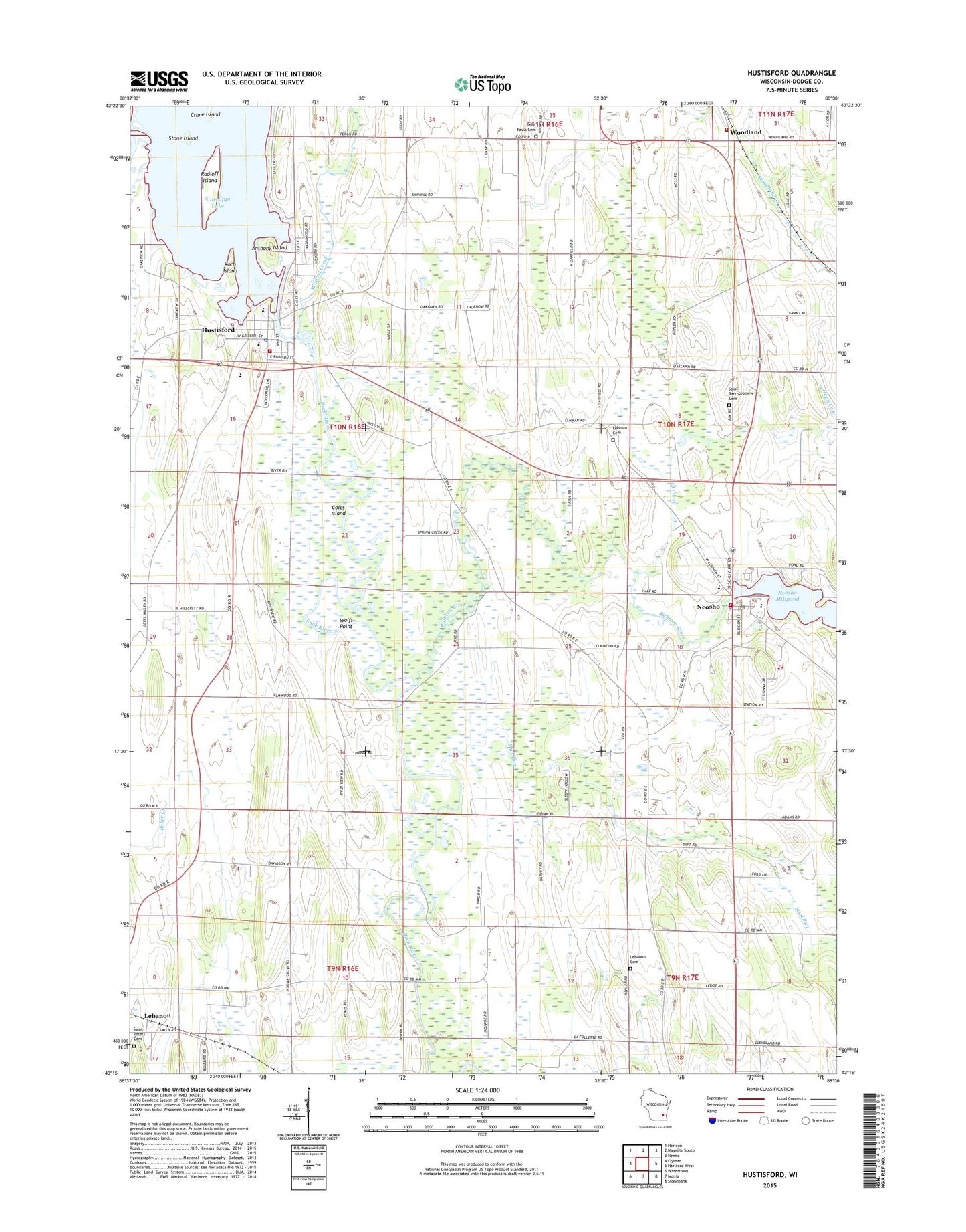
Hustisford Wisconsin US Topo Map
Couldn't load pickup availability
2022 topographic map quadrangle Hustisford in the state of Wisconsin. Scale: 1:24000. Based on the newly updated USGS 7.5' US Topo map series, this map is in the following counties: Dodge. The map contains contour data, water features, and other items you are used to seeing on USGS maps, but also has updated roads and other features. This is the next generation of topographic maps. Printed on high-quality waterproof paper with UV fade-resistant inks.
Quads adjacent to this one:
West: Clyman
Northwest: Horicon
North: Mayville South
Northeast: Nenno
East: Hartford West
Southeast: Stonebank
South: Ixonia
Southwest: Watertown
This map covers the same area as the classic USGS quad with code o43088c5.
Contains the following named places: Anthony Island, Bethany Lutheran Church, Bethany Lutheran School, Coles Island, Crane Island, First Presbyterian Church, Hepp Creek, Honor Elementary School, Hustisford, Hustisford 2WP888 Dam, Hustisford Community Library, Hustisford Fire Department, Hustisford Junior / Senior High School, Hustisford Police Department, Hustisford Post Office, John Hustis Elementary School, Koch Island, Lake Country Victory High School, Lebanon Cemetery, Lehman Cemetery, Mud Run, Neosho, Neosho / Rubicon / Ashippun Police Department, Neosho Fire Department, Neosho Millpond, Neosho Post Office, Radloff Island, Riegleman Field, Rubicon River, Saint Bartholomew Cemetery, Saint John Church, Saint Johns Cemetery, Saint Michaels Church, Saint Peters Cemetery, Sinissippi Lake, Sinissippi Lake 509, Stone Island, Town of Hustisford, Village of Hustisford, Village of Neosho, Wildcat Creek, Wolfs Point, Woodland, Woodland Road School, Woodland Volunteer Fire Department, ZIP Codes: 53034, 53059