MyTopo
Trade Lake Wisconsin US Topo Map
Couldn't load pickup availability
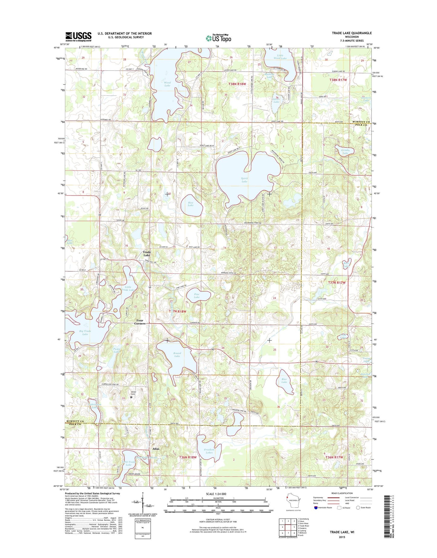
2018 topographic map quadrangle Trade Lake in the state of Wisconsin. Scale: 1:24000. Based on the newly updated USGS 7.5' US Topo map series, this map is in the following counties: Burnett, Polk. The map contains contour data, water features, and other items you are used to seeing on USGS maps, but also has updated roads and other features. This is the next generation of topographic maps. Printed on high-quality waterproof paper with UV fade-resistant inks.
Quads adjacent to this one:
West: Trade River
Northwest: Grantsburg
North: Falun
Northeast: Siren West
East: Frederic
Southeast: Luck
South: Milltown
Southwest: Cushing
Contains the following named places: Atlas, Atlas Feed Mill Mill Dam, Bass Lake School, Big Trade Lake, Four Corners, Freedom Lakes, Gabrielson Lake, Grimhs Lake, Land Lake, Little Trade Lake, Little Wood Lake, Long Trade Lake 45, Mission Church, Muskrat Lake, Pickle Lake, Pine Lake, Pole Cat Crossing, Rice Lake, Round Lake, Round Lake School, Silver Lake, Spirit Creek, Spirit Lake, Spook Lake, Town of Trade Lake, Trade Lake, Trade Lake School, Union Cemetery, Wood Lake, Wood Lake School