MyTopo
Falun Wisconsin US Topo Map
Couldn't load pickup availability
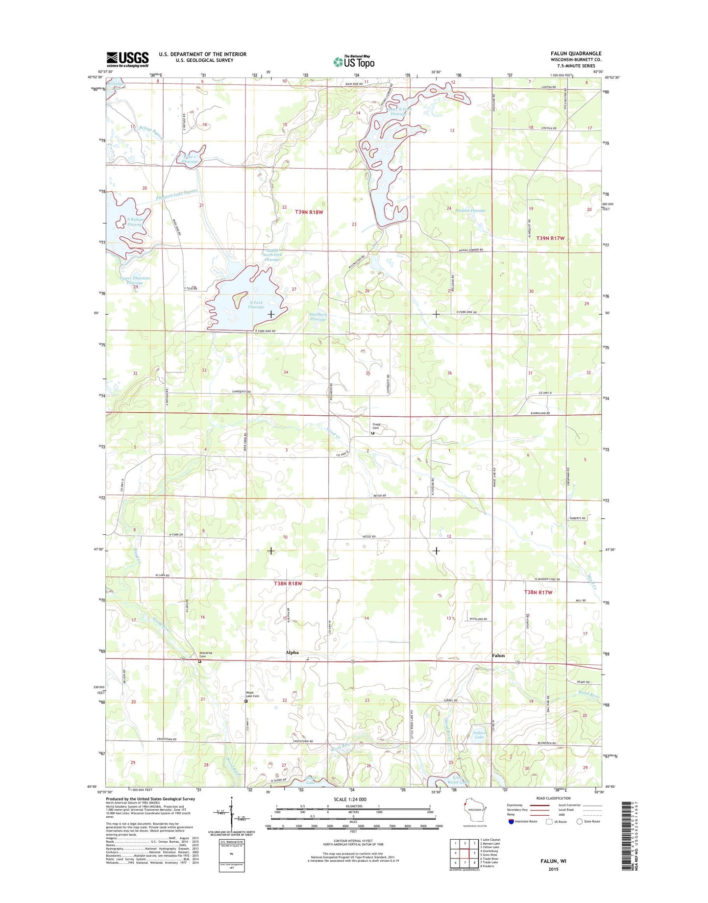
2022 topographic map quadrangle Falun in the state of Wisconsin. Scale: 1:24000. Based on the newly updated USGS 7.5' US Topo map series, this map is in the following counties: Burnett. The map contains contour data, water features, and other items you are used to seeing on USGS maps, but also has updated roads and other features. This is the next generation of topographic maps. Printed on high-quality waterproof paper with UV fade-resistant inks.
Quads adjacent to this one:
West: Grantsburg
Northwest: Lake Clayton
North: Monson Lake
Northeast: Yellow Lake
East: Siren West
Southeast: Frederic
South: Trade Lake
Southwest: Trade River
This map covers the same area as the classic USGS quad with code o45092g5.
Contains the following named places: Alpha, Ansgarius Cemetery, Crex Meadows Dam, Crex Meadows North Fork Dike, Crex Meadows State Public Hunting Grounds, Crex Meadows State Wildlife Refuge, Dike 1 Flowage, Falun, Freya Cemetery, Hildas Corner, Indian Lake, Middle North Fork Flowage, Midway Tabernacle, Nelson Elementary School, North Fork Flowage, Paulson Flowage, Phantom Lake Bypass, Pumphouse Ditch, Refuge Bypass, Sandberg Flowage, Smiths Stopping Place, South Refuge Flowage, Town of Wood River, Upper North Fork Flowage, Upper Phantom Flowage, Wood Creek, Wood Lake Cemetery