
MyTopo
Washington Island NW Wisconsin US Topo Map
Couldn't load pickup availability
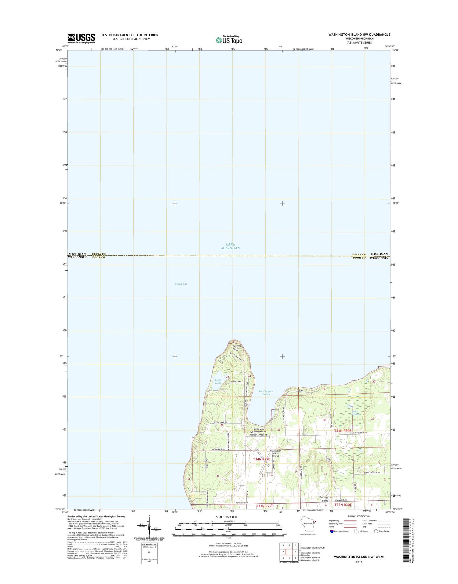
2018 topographic map quadrangle Washington Island NW in the state of Wisconsin. Scale: 1:24000. Based on the newly updated USGS 7.5' US Topo map series, this map is in the following counties: Door, Delta. The map contains contour data, water features, and other items you are used to seeing on USGS maps, but also has updated roads and other features. This is the next generation of topographic maps. Printed on high-quality waterproof paper with UV fade-resistant inks.
Quads adjacent to this one:
Northeast: Washington Island NE OE N
East: Washington Island NE
Southeast: Washington Island SE
South: Washington Island SW
Southwest: Ellison Bay
Contains the following named places: Bethel Church, Bethel Evangelical Free Church, Bowyer Bluff, Boyer Bluff Light, Coffee Swamp, Coffey Swamp State Natural Area, Island Cemetery, Little Lake, Mountain Wayside Park, Saint Michaels Chapel, School House Beach Park, Trinity Evangelical Lutheran Church, Washington, Washington Harbor, Washington Island, Washington Island Airport, Washington Island Farm Museum, Washington Island Landfill, Washington Island Volunteer Fire Department


