MyTopo
Washington Island NE Wisconsin US Topo Map
Couldn't load pickup availability
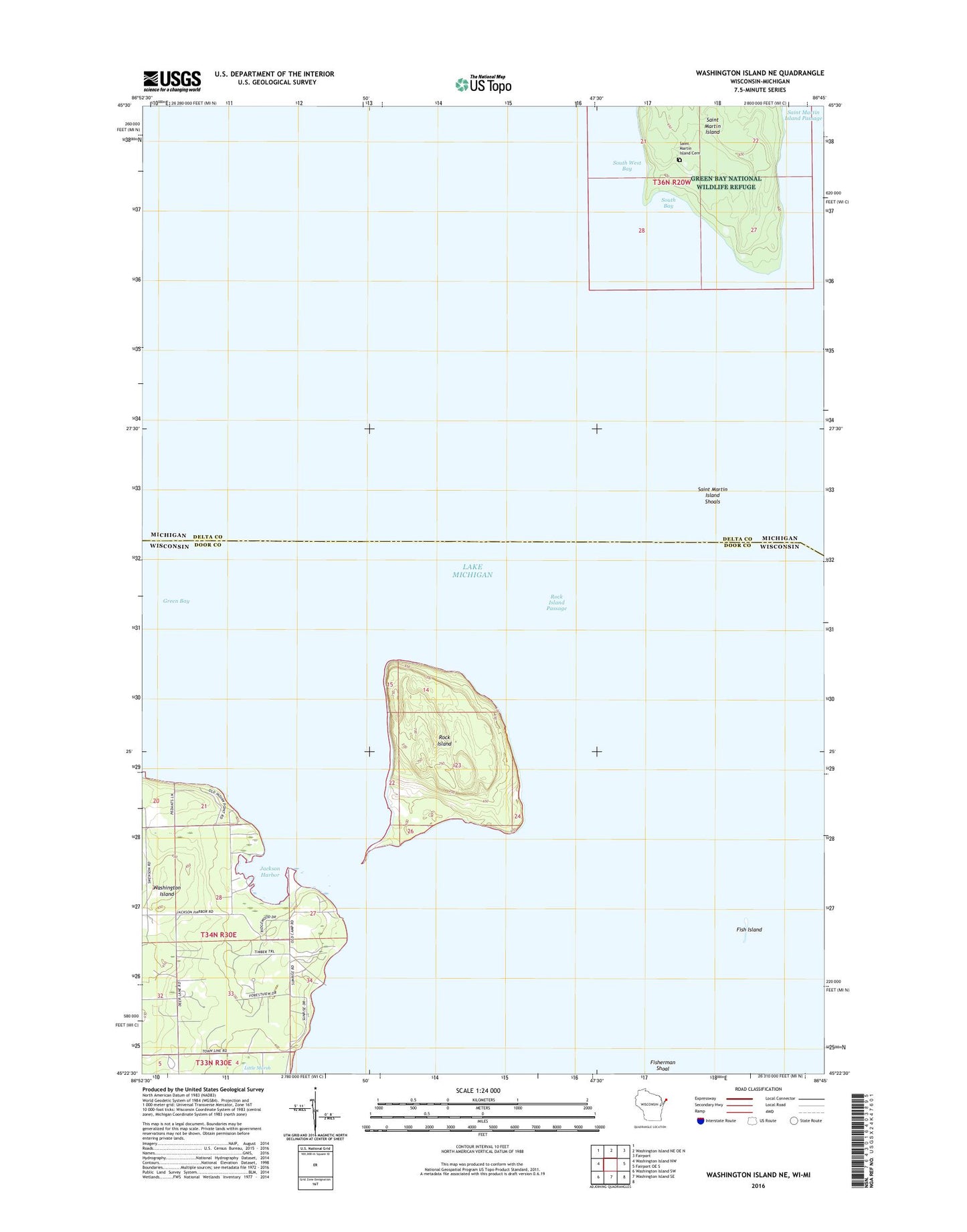
2022 topographic map quadrangle Washington Island NE in the states of Wisconsin, Michigan. Scale: 1:24000. Based on the newly updated USGS 7.5' US Topo map series, this map is in the following counties: Door, Delta. The map contains contour data, water features, and other items you are used to seeing on USGS maps, but also has updated roads and other features. This is the next generation of topographic maps. Printed on high-quality waterproof paper with UV fade-resistant inks.
Quads adjacent to this one:
West: Washington Island NW
North: Washington Island NE OE N
Northeast: Fairport
East: Fairport OE S
South: Washington Island SE
Southwest: Washington Island SW
This map covers the same area as the classic USGS quad with code o45086d7.
Contains the following named places: Fish Island, Green Bay National Wildlife Refuge, Jackson Harbor, Jackson Harbor Ridges State Natural Area, Johnson Harbor Dunes Park, Pottawatomie Light, Rock Island, Rock Island Passage, Rock Island State Park, Rock Island State Park Ferry, Rock Island Woods State Natural Area, Saint Martin Island, Saint Martin Island Cemetery, Saint Martin Island Passage, Saint Martin Island Shoals, South Bay, South West Bay