MyTopo
Washington Island SE Wisconsin US Topo Map
Couldn't load pickup availability
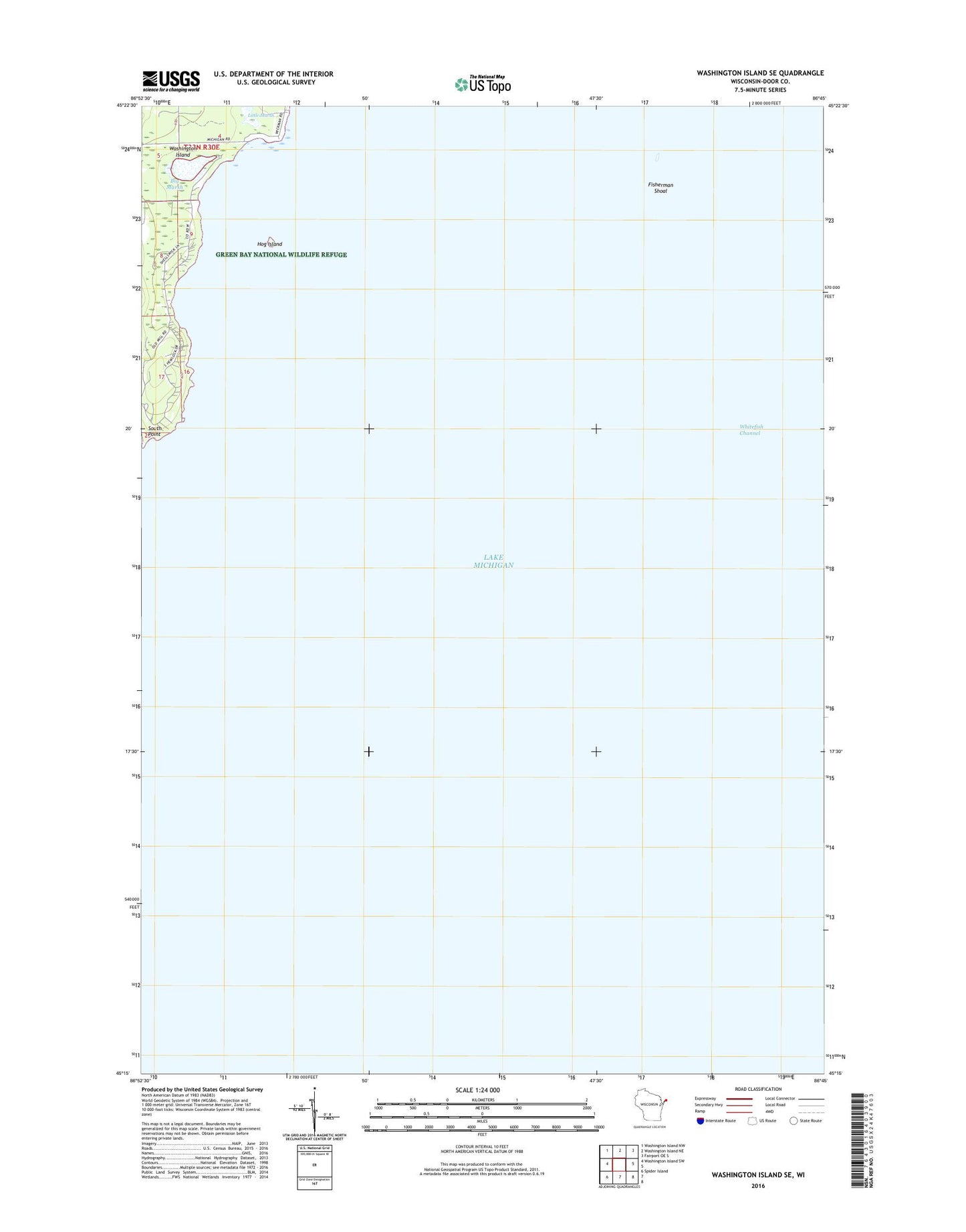
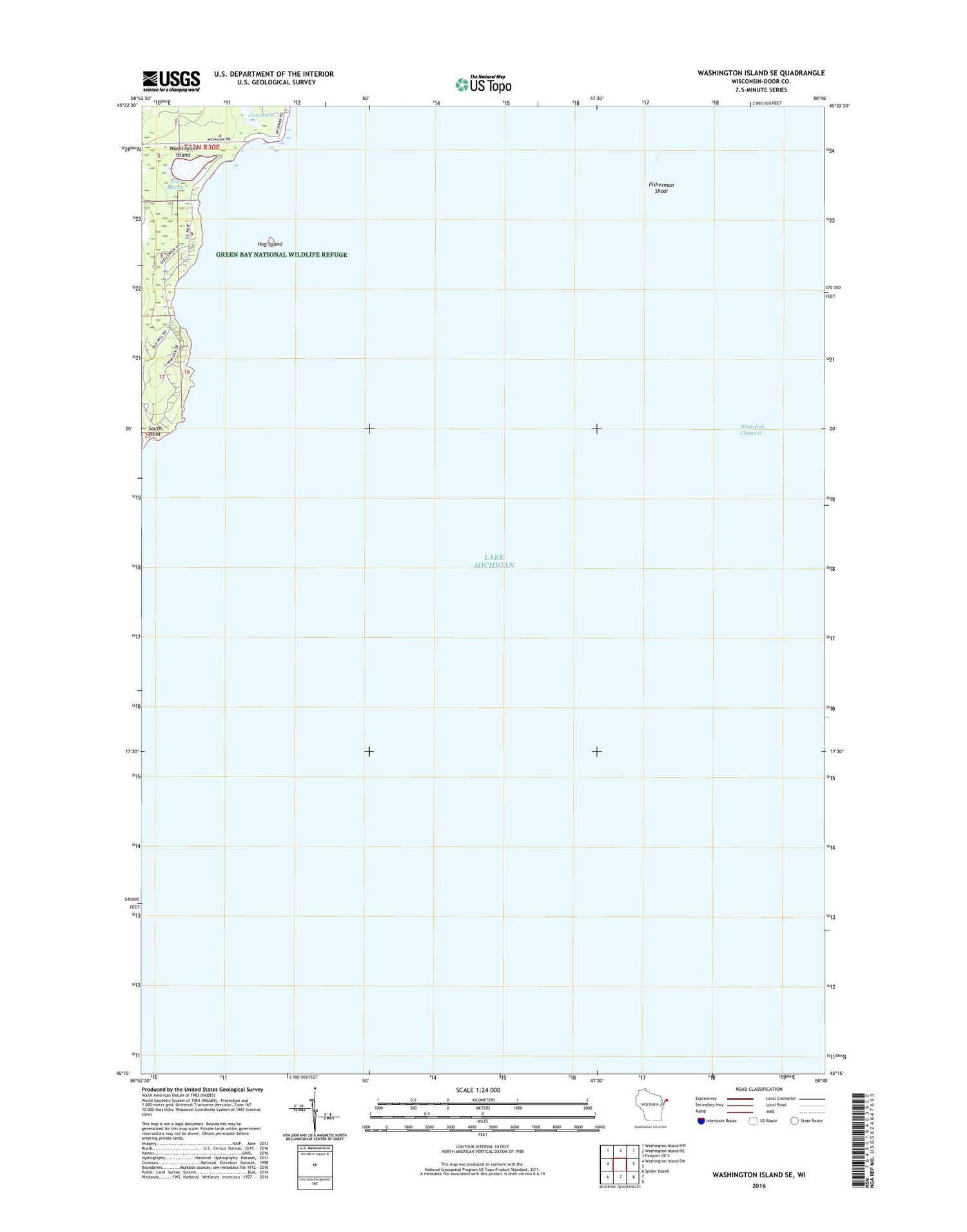
2018 topographic map quadrangle Washington Island SE in the state of Wisconsin. Scale: 1:24000. Based on the newly updated USGS 7.5' US Topo map series, this map is in the following counties: Door. The map contains contour data, water features, and other items you are used to seeing on USGS maps, but also has updated roads and other features. This is the next generation of topographic maps. Printed on high-quality waterproof paper with UV fade-resistant inks.
Quads adjacent to this one:
West: Washington Island SW
Northwest: Washington Island NW
North: Washington Island NE
Northeast: Fairport OE S
Southwest: Spider Island
Contains the following named places: Big And Little Marsh State Natural Area, Big Marsh, Eastside County Park, Fisherman Shoal, Hog Island, Little Marsh, South Point, Town of Washington, Wisconsin Islands Wilderness (Green Bay Refuge)