MyTopo
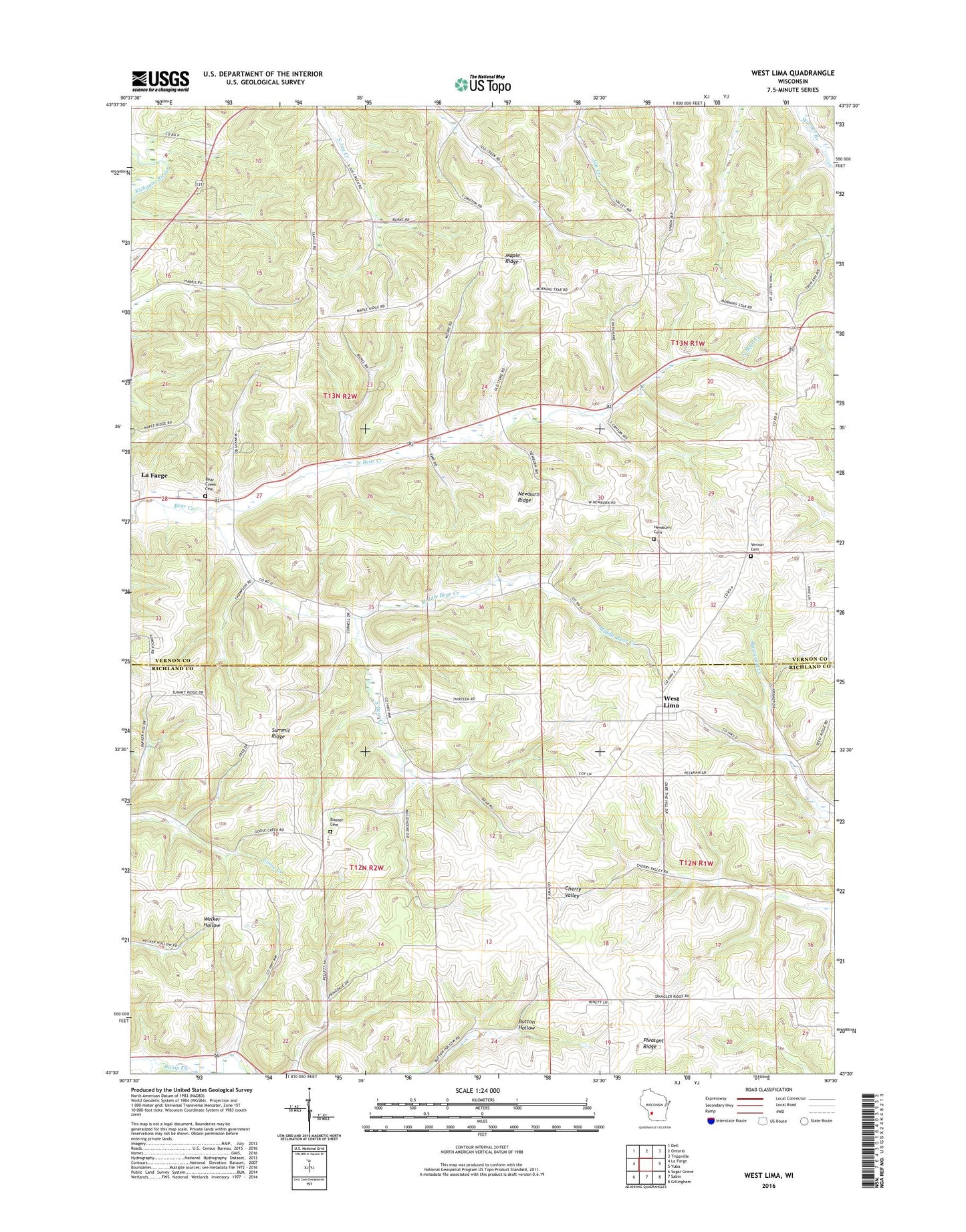
West Lima Wisconsin US Topo Map
Couldn't load pickup availability
2018 topographic map quadrangle West Lima in the state of Wisconsin. Scale: 1:24000. Based on the newly updated USGS 7.5' US Topo map series, this map is in the following counties: Vernon, Richland. The map contains contour data, water features, and other items you are used to seeing on USGS maps, but also has updated roads and other features. This is the next generation of topographic maps. Printed on high-quality waterproof paper with UV fade-resistant inks.
Quads adjacent to this one:
West: La Farge
Northwest: Dell
North: Ontario
Northeast: Trippville
East: Yuba
Southeast: Gillingham
South: Sabin
Southwest: Sugar Grove
Contains the following named places: Bear Creek Cemetery, Booher Cemetery, Booher Homestead Stock Farm, Camp Creek School, Carter School, Cloverleaf Farm, Cove Valley Stock and Grain Farm, Evergreen Farm, Good Enough Stock Farm, Goose Creek School, Great Western Stock Farm, Hickory Grove Stock Farm, Hickory Lane Farm, Highland Farm, Hillcrest Farm, Maple Ridge, Maple Ridge School, Maplewood Grove Farm, Middle Bear Creek, Morning Star School, Mueller School, Newburn Cemetery, Newburn Ridge, North Bear Creek, North Bear School, Plainview Farm, Pleasant Farm, Pleasant Ridge, South Bear Creek, South Bear School, Summit Ridge, Summit United Brethren Church, Town of Forest, Town of Stark, Union Stock Farm, Vernon Cemetery, West Lima, West Lima Census Designated Place, West Lima Stock Farm, Woodland Farm, Woodside Farm