MyTopo
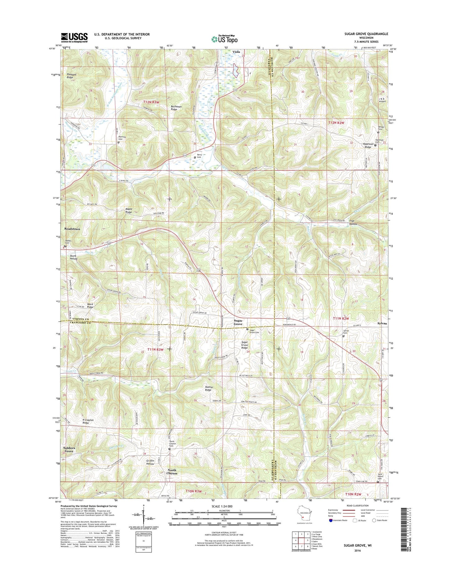
Sugar Grove Wisconsin US Topo Map
Couldn't load pickup availability
2022 topographic map quadrangle Sugar Grove in the state of Wisconsin. Scale: 1:24000. Based on the newly updated USGS 7.5' US Topo map series, this map is in the following counties: Vernon, Richland, Crawford. The map contains contour data, water features, and other items you are used to seeing on USGS maps, but also has updated roads and other features. This is the next generation of topographic maps. Printed on high-quality waterproof paper with UV fade-resistant inks.
Quads adjacent to this one:
West: Readstown
Northwest: Avalanche
North: La Farge
Northeast: West Lima
East: Sabin
Southeast: Boaz
South: Mount Zion
Southwest: Gays Mills
This map covers the same area as the classic USGS quad with code o43090d6.
Contains the following named places: Bender Cemetery, Berry Cemetery, Big Spring Landing Strip, Big Spring Stock and Grain Farm, Coher School, Cold Springs Farm, Cottage Grove Farm, Day Creek School, Elk Creek, Elk Creek School, Fish School, Five Springs Farm, Forest Home Farm, Frye Hollow, Glenwood Farm, Harrison Creek, Hoke Creek, Hopewell Cemetery, Hopewell Church, Hopewell Ridge, Hustler Ridge, Kickapoo Area Schools, Kickapoo Center, Kickapoo Elementary School, Lindencroft Farm, Maiben Cemetery, Manning Cemetery, Manning School, Maple Grove Farm, Maple Ridge, North Clayton, North Clayton Cemetery, North Clayton Ridge, Oak Grove Farm, Oakside Farm, Ogden School, Orchard Lawn Farm, Pleasant Ridge Church, Pleasant View Farm, Purple Stock Farm, Ridge View Farm, Rockdale Farm, Saint Peters Cemetery, Saint Peters Church, Skunk Hollow, Spring Valley Farm, Sugar Grove, Sugar Grove Cemetery, Sugar Grove Ridge, Sugar Grove School, Sugar Tree Farm, Sylvan, Sylvan Cemetery, Sylvan Church, Sylvan Ridge Farm, Tenny Spring Creek, Town of Kickapoo, Trout Creek School, Ward Ridge, West Fork Kickapoo River, ZIP Code: 54664