MyTopo
Anderson Canyon Wyoming US Topo Map
Couldn't load pickup availability
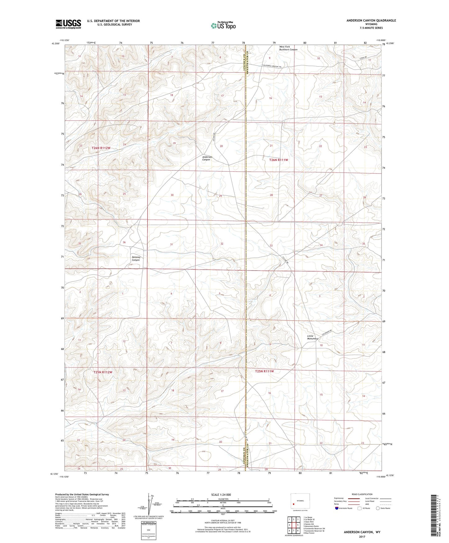
2021 topographic map quadrangle Anderson Canyon in the state of Wyoming. Scale: 1:24000. Based on the newly updated USGS 7.5' US Topo map series, this map is in the following counties: Lincoln, Sweetwater. The map contains contour data, water features, and other items you are used to seeing on USGS maps, but also has updated roads and other features. This is the next generation of topographic maps. Printed on high-quality waterproof paper with UV fade-resistant inks.
Quads adjacent to this one:
West: Names Hill
Northwest: La Barge
North: La Barge SE
Northeast: Oasis Well
East: Monument Butte
Southeast: Blue Forest
South: Fontenelle Reservoir SE
Southwest: Fontenelle Reservoir SW
Contains the following named places: Little Colorado Well Number 5, Little Colorado Well Number 6, Little Monument