MyTopo
Fontenelle Reservoir SE Wyoming US Topo Map
Couldn't load pickup availability
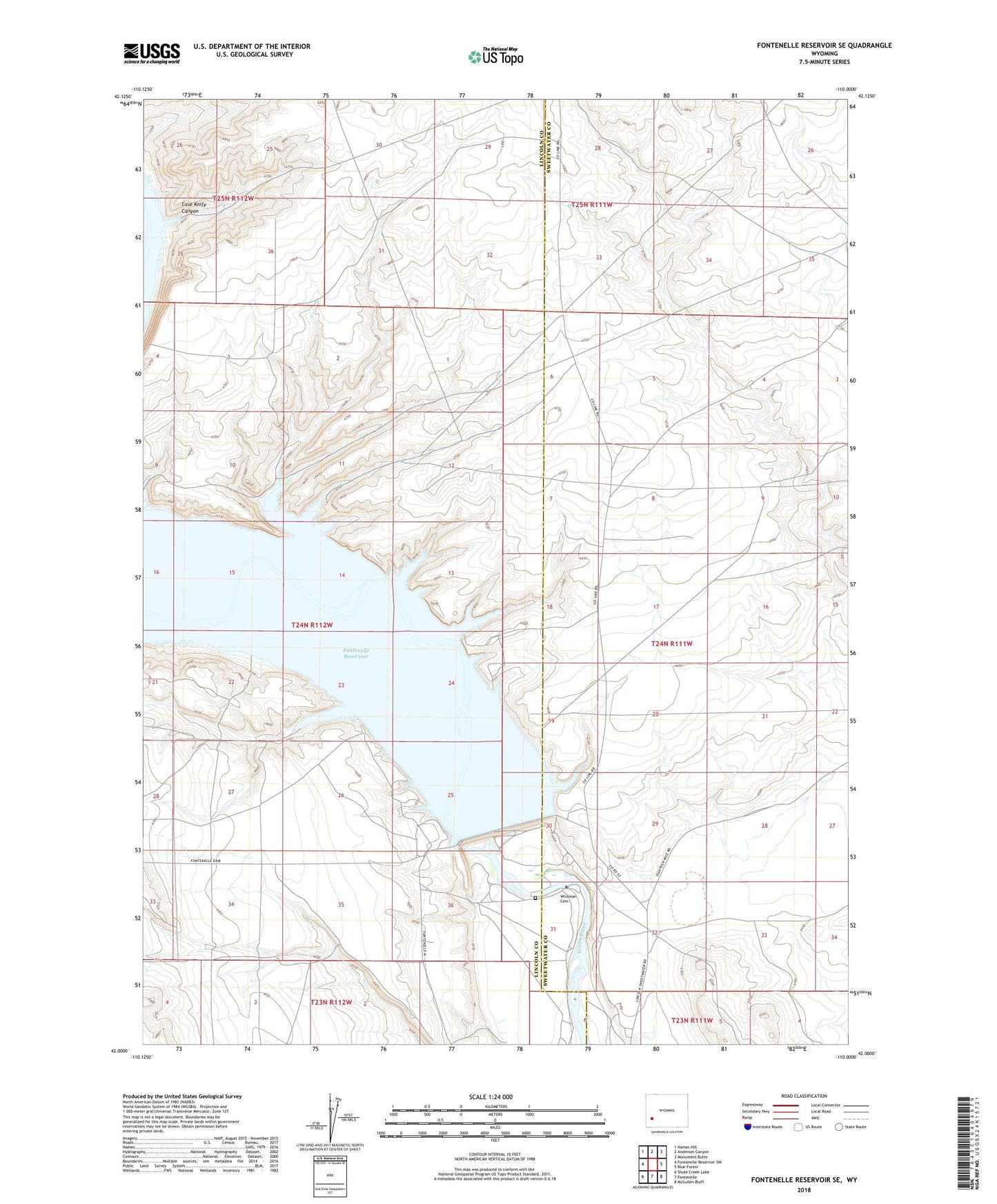
2021 topographic map quadrangle Fontenelle Reservoir SE in the state of Wyoming. Scale: 1:24000. Based on the newly updated USGS 7.5' US Topo map series, this map is in the following counties: Lincoln, Sweetwater. The map contains contour data, water features, and other items you are used to seeing on USGS maps, but also has updated roads and other features. This is the next generation of topographic maps. Printed on high-quality waterproof paper with UV fade-resistant inks.
Quads adjacent to this one:
West: Fontenelle Reservoir SW
Northwest: Names Hill
North: Anderson Canyon
Northeast: Monument Butte
East: Blue Forest
Southeast: McCullen Bluff
South: Fontenelle
Southwest: Shute Creek Lake
This map covers the same area as the classic USGS quad with code o42110a1.
Contains the following named places: Case Knife Canyon, Fontenelle Dam, Fontenelle Reservoir, Whitman Cemetery