MyTopo
Arminto SW Wyoming US Topo Map
Couldn't load pickup availability
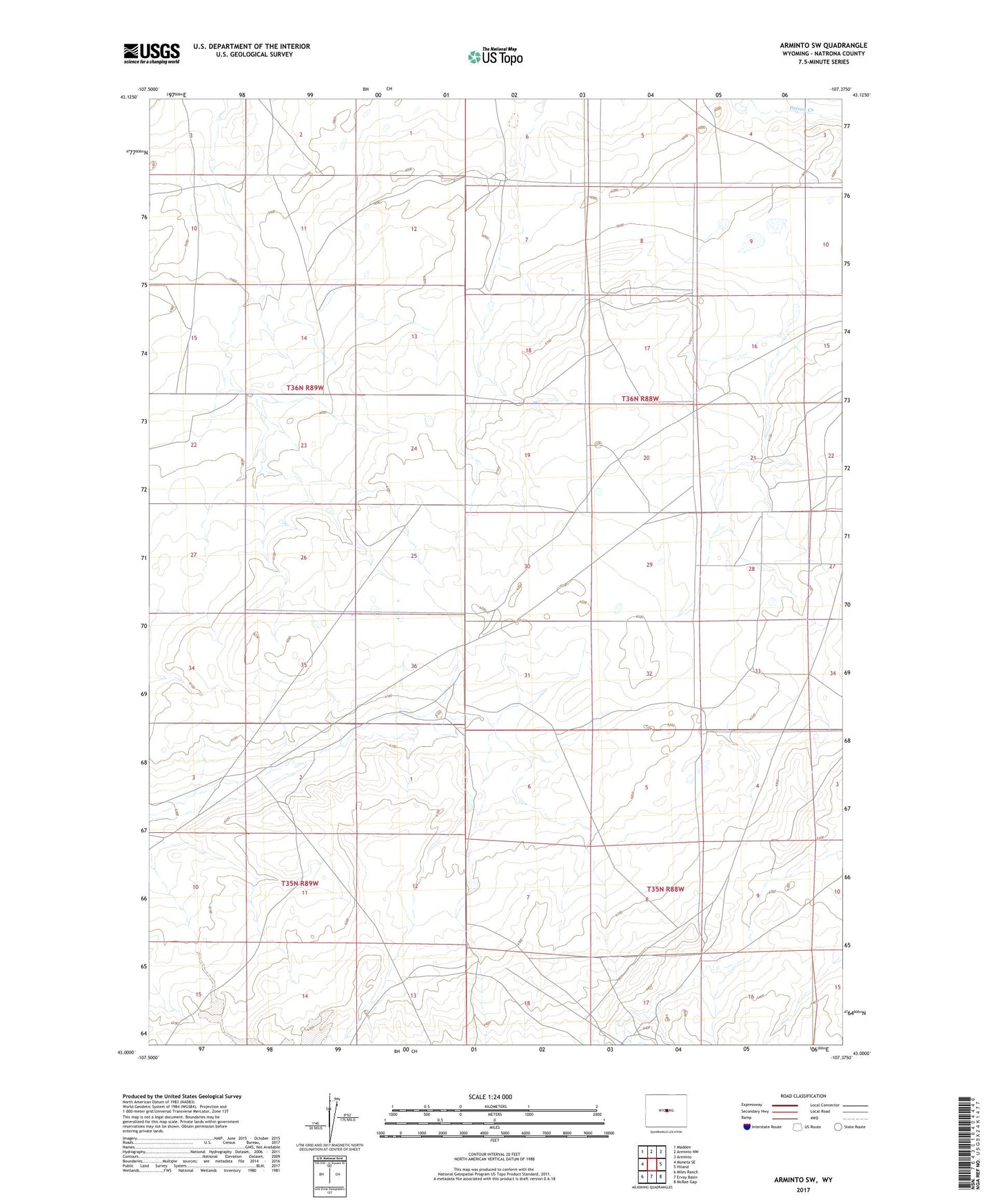
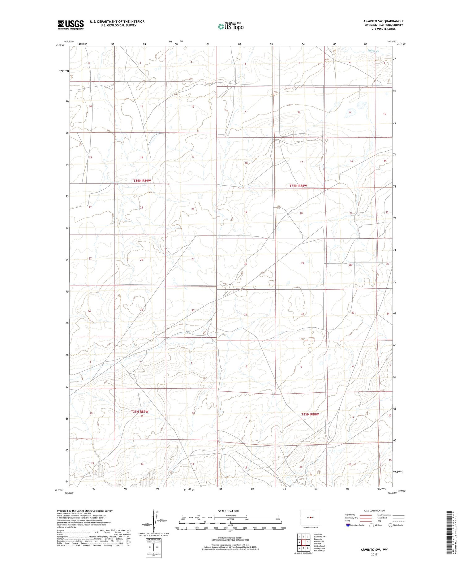
2021 topographic map quadrangle Arminto SW in the state of Wyoming. Scale: 1:24000. Based on the newly updated USGS 7.5' US Topo map series, this map is in the following counties: Natrona. The map contains contour data, water features, and other items you are used to seeing on USGS maps, but also has updated roads and other features. This is the next generation of topographic maps. Printed on high-quality waterproof paper with UV fade-resistant inks.
Quads adjacent to this one:
West: Moneta SE
Northwest: Madden
North: Arminto NW
Northeast: Arminto
East: Hiland
Southeast: McRae Gap
South: Ervay Basin
Southwest: Miles Ranch
Contains the following named places: Dick Number Five Mine, Divide School, Neff Ranch, O'Donnel Ranch, Osborne Place, Poison Creek School, Shot Numbers Nine and Ten Mine, Star Number Three Mine, Walt Number Three Mine, Windy Kay Number Nine Mine