MyTopo
Black Mountain Wyoming US Topo Map
Couldn't load pickup availability
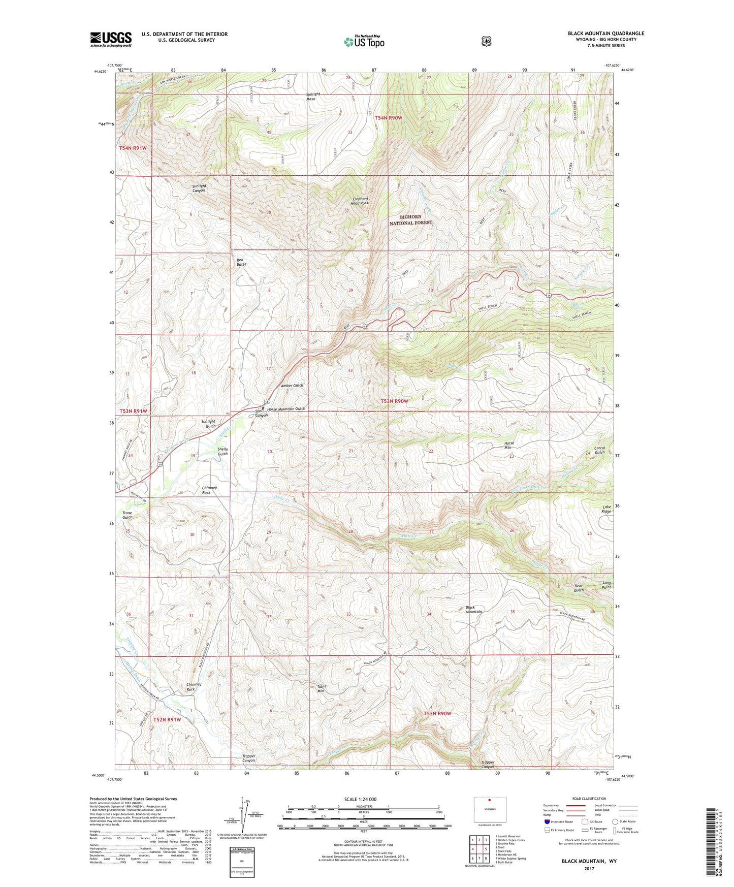
2021 topographic map quadrangle Black Mountain in the state of Wyoming. Scale: 1:24000. Based on the newly updated USGS 7.5' US Topo map series, this map is in the following counties: Big Horn. The map contains contour data, water features, and other items you are used to seeing on USGS maps, but also has updated roads and other features. This is the next generation of topographic maps. Printed on high-quality waterproof paper with UV fade-resistant inks.
Quads adjacent to this one:
West: Shell
Northwest: Leavitt Reservoir
North: Hidden Tepee Creek
Northeast: Granite Pass
East: Shell Falls
Southeast: Bush Butte
South: White Sulphur Spring
Southwest: Manderson NE
Contains the following named places: Amber Gulch, Barrel Spring, Bear Gulch, Black Mountain, Bush Creek, Cedar Creek, Chimney Rock, Corral Gulch, Cottonwood Creek, Dry Fork White Creek, Elephant Head Rock, Fender Creek, Hatten Ditch, Horse Mountain, Horse Mountain Gulch, Iowa State University Geology Camp, Kershner Ditch, McNay Creek, Post Creek, Post Creek Picnic Area, Red Butte, Shell Canyon, Shell Creek Canyon Mine, Shelly Gulch, Spring Creek, Sunlight Canyon, Sunlight Gulch, Survey Creek, Table Mountain, Trapper Canyon, Trapper Lodge Ranch, Trone Gulch, White Creek