MyTopo
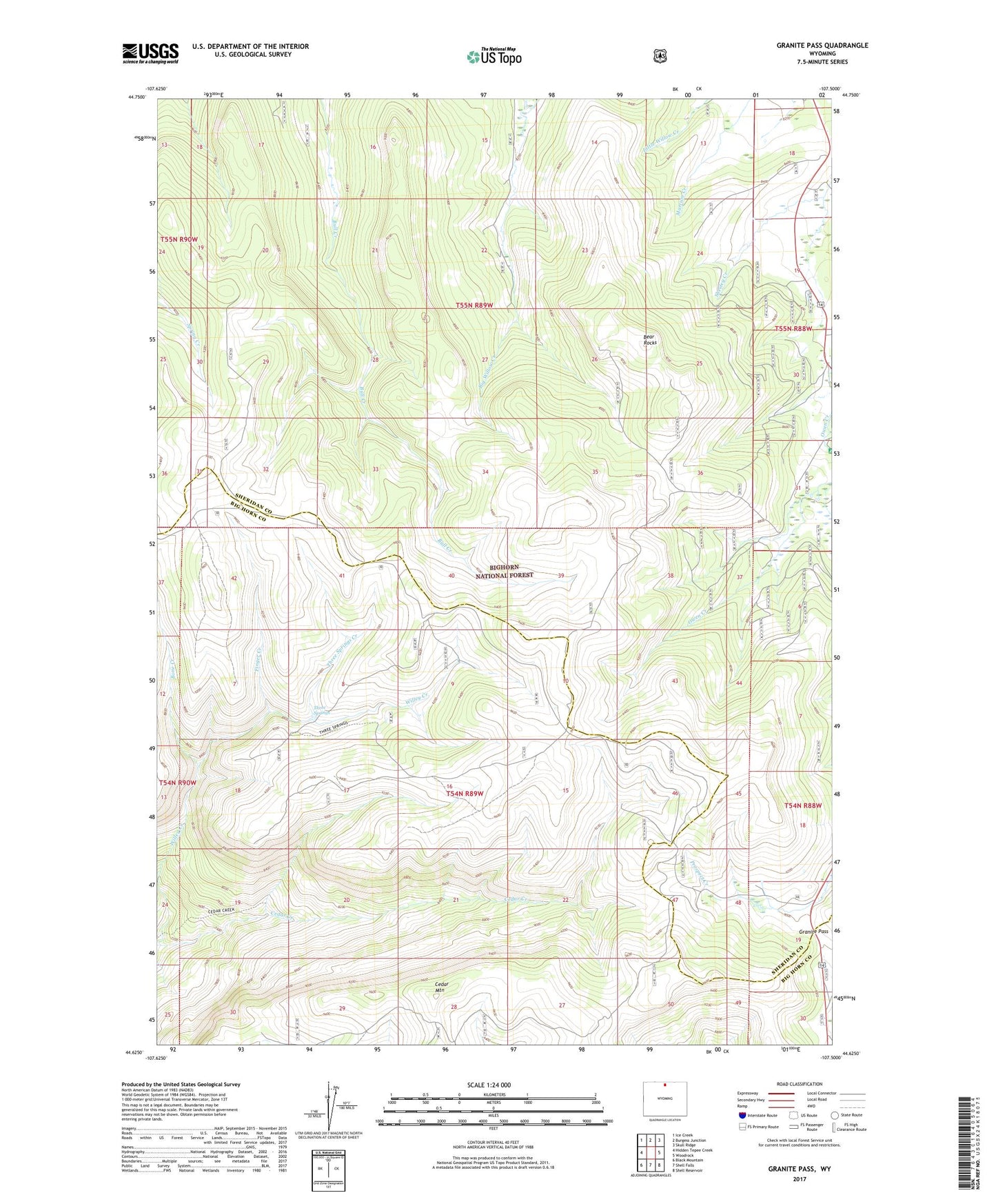
Granite Pass Wyoming US Topo Map
Couldn't load pickup availability
Also explore the Granite Pass Forest Service Topo of this same quad for updated USFS data
2021 topographic map quadrangle Granite Pass in the state of Wyoming. Scale: 1:24000. Based on the newly updated USGS 7.5' US Topo map series, this map is in the following counties: Sheridan, Big Horn. The map contains contour data, water features, and other items you are used to seeing on USGS maps, but also has updated roads and other features. This is the next generation of topographic maps. Printed on high-quality waterproof paper with UV fade-resistant inks.
Quads adjacent to this one:
West: Hidden Tepee Creek
Northwest: Ice Creek
North: Burgess Junction
Northeast: Skull Ridge
East: Woodrock
Southeast: Shell Reservoir
South: Shell Falls
Southwest: Black Mountain
This map covers the same area as the classic USGS quad with code o44107f5.
Contains the following named places: Bear Rocks, Bone Creek, Cedar Mountain, Finger Creek, Granite Pass, Owen Creek Campground, Three Springs, Three Springs Creek