MyTopo
Bristol Ridge Wyoming US Topo Map
Couldn't load pickup availability
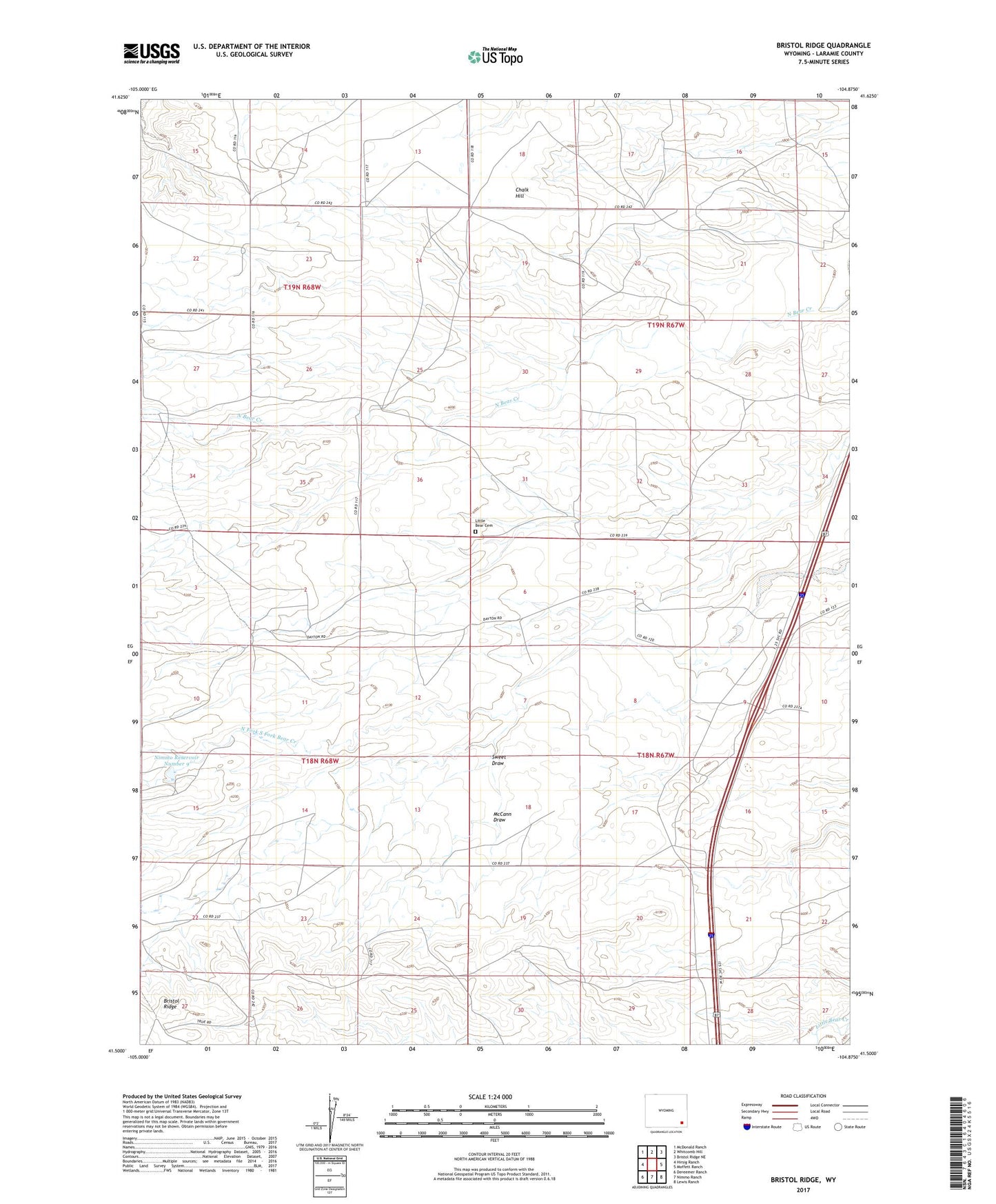
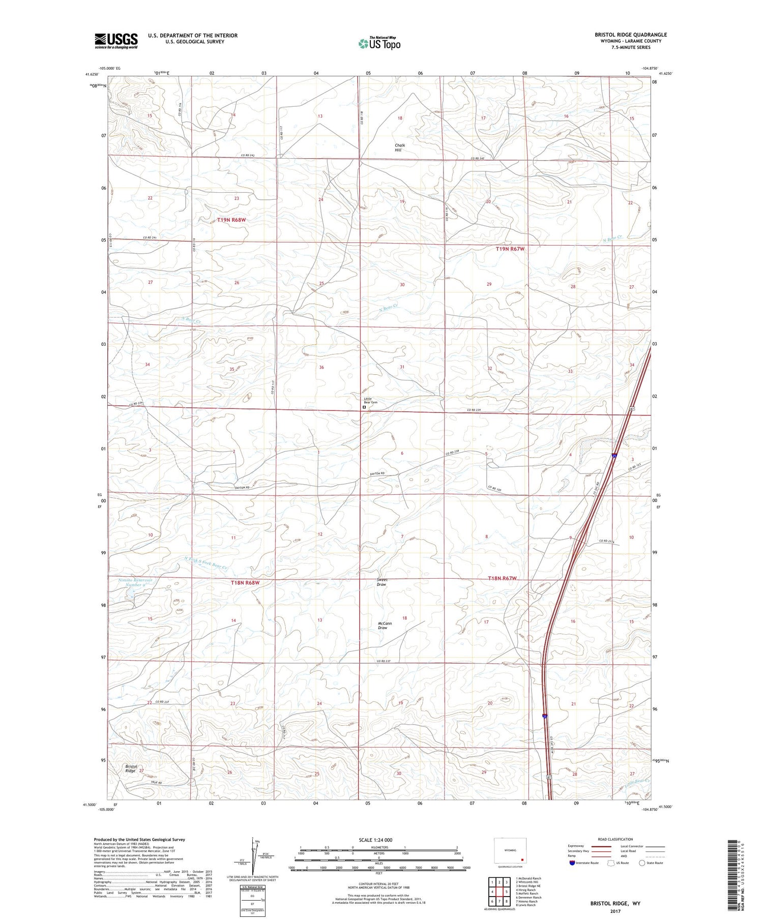
2021 topographic map quadrangle Bristol Ridge in the state of Wyoming. Scale: 1:24000. Based on the newly updated USGS 7.5' US Topo map series, this map is in the following counties: Laramie. The map contains contour data, water features, and other items you are used to seeing on USGS maps, but also has updated roads and other features. This is the next generation of topographic maps. Printed on high-quality waterproof paper with UV fade-resistant inks.
Quads adjacent to this one:
West: Hirsig Ranch
Northwest: McDonald Ranch
North: Whitcomb Hill
Northeast: Bristol Ridge NE
East: Moffett Ranch
Southeast: Lewis Ranch
South: Nimmo Ranch
Southwest: Dereemer Ranch
Contains the following named places: Bert Gillaspie Ranch, Bliss Pumping Station, Bristol Ridge, Caster Ranch, Chalk Hill, Collins Ranch, Dick Duvall Ranch, Elvy Gillaspie Ranch, F L Duvall Ranch, Harry Dayton Ranch, Hoyt Duvall Ranch, Little Bear Cemetery, Mable Ranch, McCann Draw, Nimmo Reservoir Number 9, North Fork South Fork Bear Creek, Richards Hall, Russell Dayton Ranch, Sweet Draw