MyTopo
Dereemer Ranch Wyoming US Topo Map
Couldn't load pickup availability
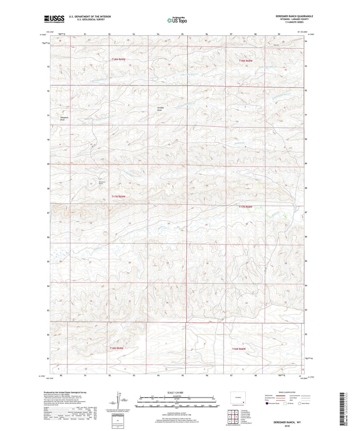
2021 topographic map quadrangle Dereemer Ranch in the state of Wyoming. Scale: 1:24000. Based on the newly updated USGS 7.5' US Topo map series, this map is in the following counties: Laramie. The map contains contour data, water features, and other items you are used to seeing on USGS maps, but also has updated roads and other features. This is the next generation of topographic maps. Printed on high-quality waterproof paper with UV fade-resistant inks.
Quads adjacent to this one:
West: Horse Creek
Northwest: Farthing
North: Hirsig Ranch
Northeast: Bristol Ridge
East: Nimmo Ranch
Southeast: Farthing Ranch
South: Federal
Southwest: Islay
This map covers the same area as the classic USGS quad with code o41105d1.
Contains the following named places: Carey Creek, Dereemer Ranch, Gundby Draw, Horse Creek Oil Field, Sheppard Draw, Whitaker Ranch